
| Official name | Republic of Senegal |
| Name in local language | République du Sénégal (fr) |
| Continent | Africa |
| Subcontinent | Sub-Saharan Africa |
| Population (ranking: 71e) | 17,215,428 inhabitants (2021) |
| Population growth | 3.06 % / year |
| Area | 196,712 km² |
| Density | 87.52 inhabitants / km² |
| GDP (ranking: 113e) | 24.578 billions $USD (2019) |
| GDP/capita (ranking) | 1,447 $USD (2019) |
| GDP growth | 5.30 % / year (2019) |
| Life expectancy (ranking) | 67.80 years (2020) |
| Birth rate | 36.10 ‰ (2020) |
| Fertility rate | 4.93 children / woman (2020) |
| Death rate (ranking) | 6.60 ‰ (2020) |
| Infant mortality rate (ranking) | 37.10 ‰ (2020) |
| Literacy rate | 57.67 % (2015) |
| Official languages | French (Wolof spoken) |
| Currency | CFA franc (XAF) |
| HDI (ranking: 205e) | 0.512 / 1 (2019) |
| EPI (ranking) | 49.52 (2018) |
| Government | Semi-presidential republic |
| Head of State | President Macky Sall |
| National Day | 4 April (independence of 1960) |
| ISO Codes | SN, SEN |
| Demonym | Senegalese |
| Tourists (ranking) | 1,365,000 people (2017) |
Sustained development but constrained by the global crisis
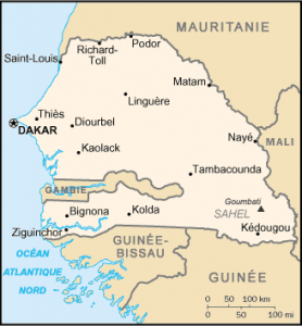
Senegal is a country located in West Africa. It is bordered by the Atlantic Ocean to the west, Mauritania to the north, Mali to the east, Guinea and Guinea-Bissau to the south. The Gambia forms a virtual enclave in the country, cutting the country in half and penetrating more than 300 km inland. The Cape Verde Islands are located 560 km off the coast of Senegal. The country owes its name to the river that borders on the east and north and has its source in Fouta Djallon in Guinea. The climate is tropical and dry with two seasons: the dry season and the rainy season.
See all related maps or articles
Urban areas (2021)
| Urban areas | Population |
|---|---|
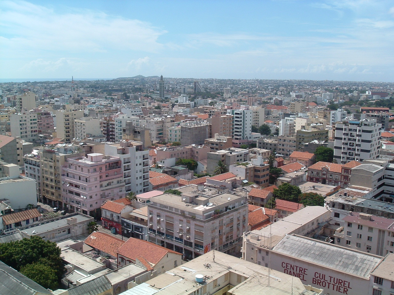
| Dakar | 3,938,358 inhabitants |
| Touba | 965,422 inhabitants |
| Mbour | 830,495 inhabitants |
| Thiès | 829,174 inhabitants |
| Kaolack | 625,022 inhabitants |
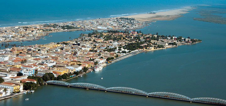
| Saint-Louis | 365,534 inhabitants |
| Diourbel | 343,736 inhabitants |
| Ziguinchor | 319,425 inhabitants |
See all urban areas
Administrative divisions
| Regions | Population | Area |
|---|---|---|
| Dakar | 3,938,358 inhabitants | 547 km² |
| Diourbel | 1,919,090 inhabitants | 4,824 km² |
| Fatick | 932,629 inhabitants | 6,849 km² |
| Kaffrine | 755,172 inhabitants | 11,262 km² |
| Kaolack | 1,228,746 inhabitants | 5,357 km² |
| Kédougou | 196,991 inhabitants | 16,800 km² |
| Kolda | 848,348 inhabitants | 13,771 km² |
| Louga | 1,091,268 inhabitants | 24,889 km² |
| Matam | 760,588 inhabitants | 29,445 km² |
| Saint-Louis | 1,120,585 inhabitants | 19,241 km² |
| Sédhiou | 591,970 inhabitants | 7,341 km² |
| Tambacounda | 904,032 inhabitants | 42,364 km² |
| Thiès | 2,221,097 inhabitants | 6,670 km² |
| Ziguinchor | 706,554 inhabitants | 7,352 km² |