
| Official name | Islamic Republic of Mauritania |
| Name in local language | République islamique de Mauritanie (fr) ; الجمهورية الإسلامية الموريتانية (ar) |
| Continent | Africa |
| Subcontinent | Sub-Saharan Africa |
| Population (ranking: 134e) | 3,984,110 inhabitants (2018) |
| Population growth | 2.32 % / year |
| Area | 1,030,700 km² |
| Density | 3.87 inhabitants / km² |
| GDP (ranking: 173e) | 5.366 billions $USD (2018) |
| GDP/capita (ranking) | 1,219 $USD (2018) |
| GDP growth | 3.60 % / year (2018) |
| Life expectancy (ranking) | 64.70 years (2018) |
| Birth rate | 32.31 ‰ (2013) |
| Fertility rate | 4.30 children / woman (2013) |
| Death rate (ranking) | 10.90 ‰ (2013) |
| Infant mortality rate (ranking) | 72.00 ‰ (2013) |
| Literacy rate | 62.64 % (2015) |
| Official languages | Arabic, French |
| Currency | Ouguiya (MRO) |
| HDI (ranking: 200e) | 0.527 / 1 (2018) |
| EPI (ranking) | 39.24 (2018) |
| Government | Unitary semi-presidential Islamic republic |
| Head of State | President Mohamed Ould Ghazouani |
| National Day | 28 November (independence of 1960) |
| ISO Codes | MR, MRT |
| Demonym | Mauritanian |
| Tourists (ranking) | 1,470 people (2017) |
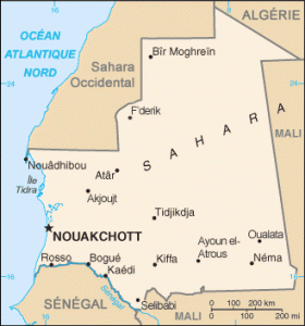
Mauritania is a country in northwestern Africa, bordering Algeria and Western Sahara to the north, Mali to the east, and Senegal to the south, with which it shares the Senegal River. It is bordered to the west by the Atlantic Ocean, along a coastline over 700 kilometers long.
See all related maps or articles
Urban areas (2017)
| Urban areas | Population |
|---|---|
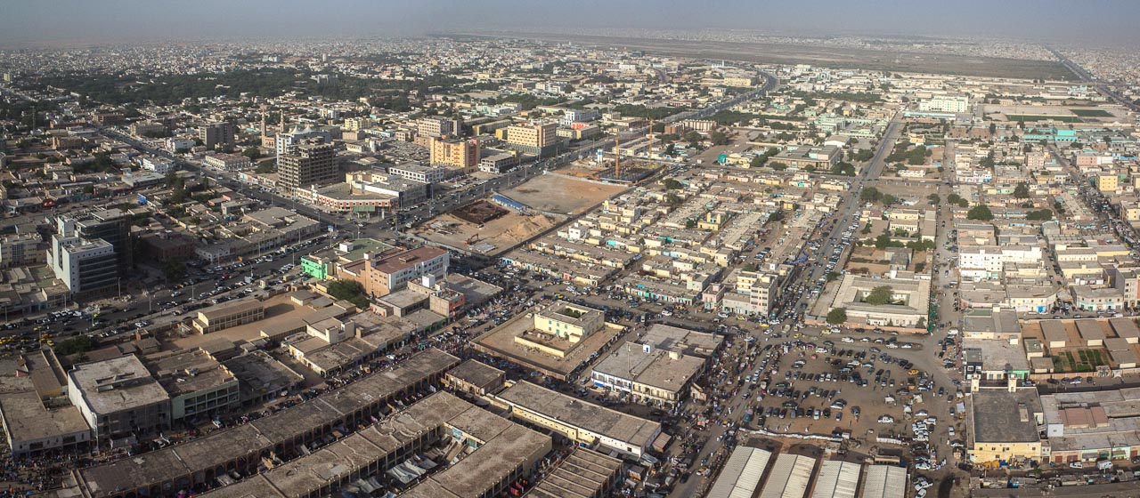
| Nouakchott | 1,116,739 inhabitants |
| Nouadhibou | 132,246 inhabitants |
| Fessale (Fassalé) | 65,927 inhabitants |
| Kiffa | 55,499 inhabitants |
| Kaédi | 48,537 inhabitants |
| Adel Bagrou | 47,829 inhabitants |
| Zouérate | 46,286 inhabitants |
| Boghé (Bogué) | 42,759 inhabitants |
| Bougadoum | 40,341 inhabitants |
| Atar | 38,877 inhabitants |
| Rosso | 35,847 inhabitants |
| Néma | 24,419 inhabitants |
| Bousteille | 20,327 inhabitants |
See all urban areas
Administrative divisions
| Regions (Wilayas) | Population | Area |
|---|---|---|
| Adrar | 61,196 inhabitants | 235,000 km² |
| Assaba | 360,249 inhabitants | 36,600 km² |
| Brakna | 320,447 inhabitants | 33,000 km² |
| Dakhlet Nouadhibou | 138,526 inhabitants | 22,300 km² |
| Gorgol | 358,027 inhabitants | 13,600 km² |
| Guidimakha (Guidimagha) | 294,506 inhabitants | 10,300 km² |
| Hodh Ech Chargui | 478,464 inhabitants | 182,700 km² |
| Hodh El Gharbi | 313,681 inhabitants | 53,400 km² |
| Inchiri | 22,833 inhabitants | 46,800 km² |
| Nouakchott | 1,116,739 inhabitants | 1,000 km² |
| Tagant | 82,683 inhabitants | 98,340 km² |
| Tiris Zemmour | 55,213 inhabitants | 252,900 km² |
| Trarza | 291,210 inhabitants | 67,800 km² |