Mauritius March 17, 2021 Africa , Agalega , archipelago , British colony , British Commonwealth , canne à sucre , Carajos , Cargados , Chagos , colony , COMESA , Commonwealth , East Africa , English language , Francophonie , French colony , French language , île Maurice , Indian Ocean , Indianoceania , islands , Mascareignes , Maurice , Mauritius , Organisation internationale de la Francophonie , Port-Louis , Rodrigues , SADC , Saint-Brandon , Tigre de l'Afrique , tourism , Tromelin Official name Republic of Mauritius Name in local language Republic of Mauritius (en) ; République de Maurice (fr) Continent Africa Subcontinent East Africa Population (ranking: 162e ) 1,266,030 inhabitants (2021) Population growth 0.04 % / year Area 2,007 km² Density 630.81 inhabitants / km² GDP (ranking: 136e )14.048 billions $USD (2019) GDP/capita (ranking ) 11,099 $USD (2019) GDP growth 3.00 % / year (2019) Life expectancy (ranking ) 74.45 years (2019) Birth rate 10.60 ‰ (2020) Fertility rate 1.40 children / woman (2019) Death rate (ranking ) 8.70 ‰ (2020) Infant mortality rate (ranking ) 14.90 ‰ (2020) Literacy rate 98.72 % (2015) Official languages None (de jure), English, Creole and French (majority) Currency Mauritian rupee (MUR) HDI (ranking: 87e )0.804 / 1 (2019) EPI (ranking )56.63 (2018) Government Unitary parliamentary republic Head of State President Prithvirajsing Roopun, also known as Pradeep Roopun National Day 12 March (independence of 1968) ISO Codes MU, MUS Demonym Mauritian Tourists (ranking ) 1,383,488 people (2019)
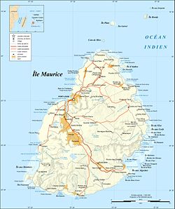
Stagnation of the population Mauritius is a state of the Indian Ocean, located about 173 kilometers from Reunion , an island belonging to France , and 881 kilometers east of Madagascar . It consists of Mauritius, Rodrigues (560 kilometers east), the Agalega Islands and the archipelago of Saint-Brandon which are part of the Mascarene archipelago (with Reunion). Mauritius claims sovereignty over the Chagos Archipelago (United Kingdom ) and the island of Tromelin (France).
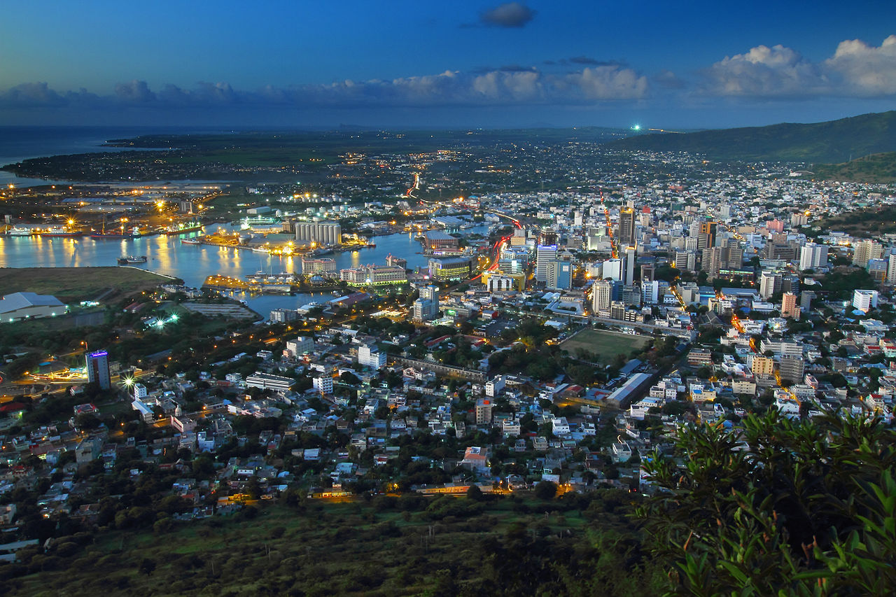
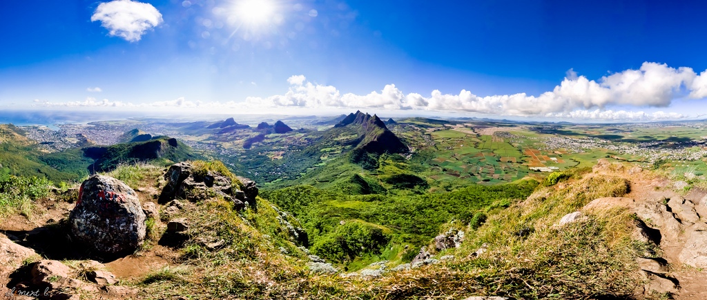
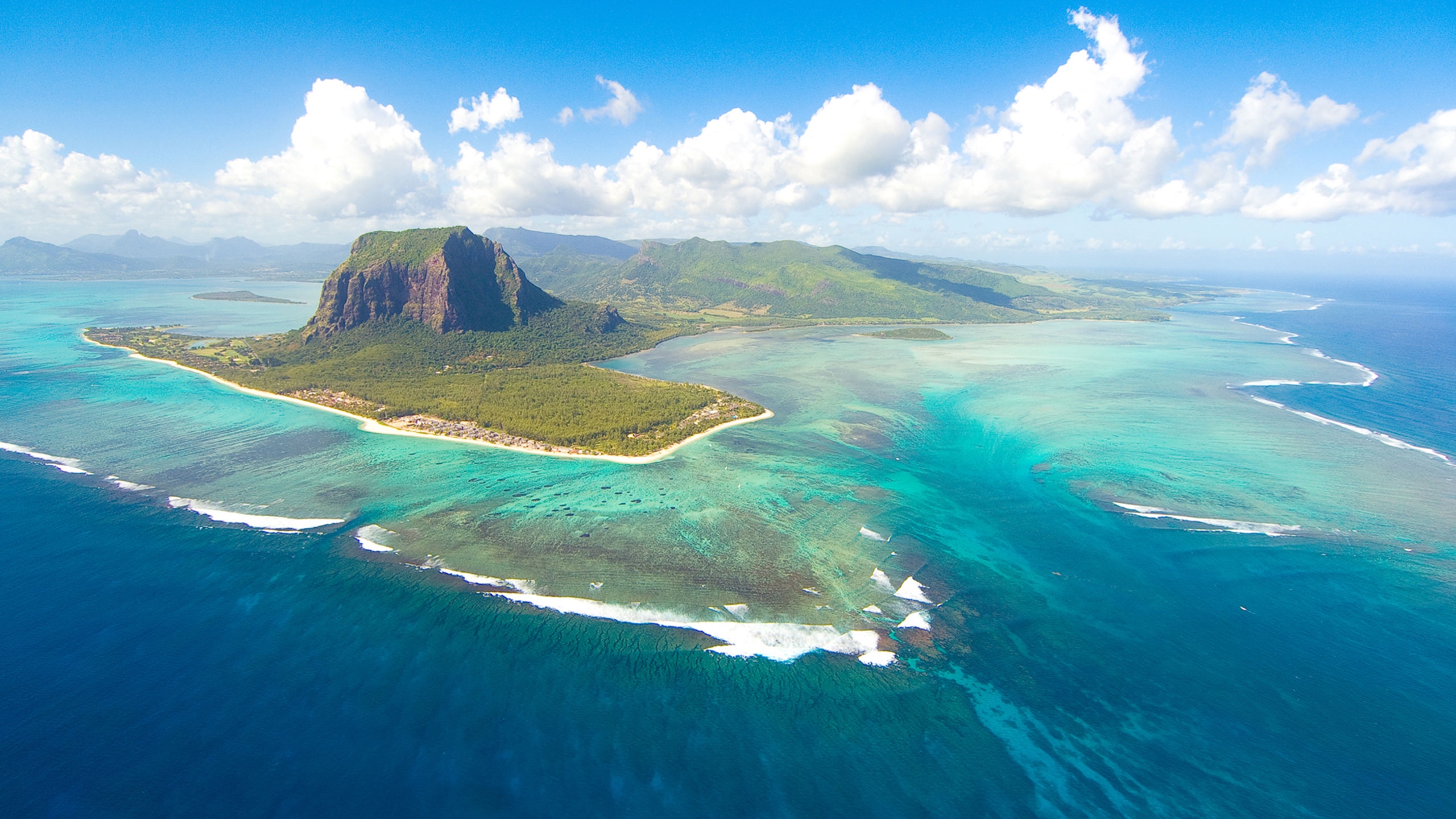
Port Louis, capitale of Mauritius. Photo: Peter Kuchar Panorama of Mauritius, seen from Le Pouce mountain. Photo: Clément Larher Le Morne Brabant mountain, in Mauritius. Photo: Wikipedia Urban areas (2016) Urban areas Population Port-Louis 900,488 inhabitants
Administrative divisions Islands and Districts Population Area Agaléga and Saint-Brandon (Cargados and Carajos) (Island) 274 inhabitants 29 km² Flacq 138,460 inhabitants 299 km² Grand Port 112,997 inhabitants 261 km² Mauritius (Island) 1,221,759 inhabitants 1,868 km² Moka 83,251 inhabitants 234 km² Pamplemousses 139,966 inhabitants 180 km² Plaines Wilhems 368,621 inhabitants 196 km² Port-Louis 119,706 inhabitants 40 km² Rivière du Rempart 108,005 inhabitants 154 km² Rivière Noire 80,939 inhabitants 257 km² Rodrigues (Island) 43,997 inhabitants 110 km² Savanne 68,585 inhabitants 246 km²
See also