Palau

Official nameRepublic of Palau
Name in local languageBelau - Beluu er a Belau (pau)
ContinentOceania
SubcontinentOceania
Population (ranking: 234e)17,820 inhabitants (2018)
Population growth0.30 % / year
Area416 km²
Density42.84 inhabitants / km²
GDP (ranking: 236e)0.310 billions $USD (2018)
GDP/capita (ranking)17,318 $USD (2018)
GDP growth5.00 % / year (2018)
Life expectancy (ranking)73.70 years (2018)
Birth rate10.68 ‰ (2010)
Fertility rate2.21 children / woman (2015)
Death rate (ranking)7.81 ‰ (2010)
Infant mortality rate (ranking)12.78 ‰ (2010)
Literacy rate98.66 % (2015)
Official languagesEnglish, Palauan, Japanese
CurrencyUnited States dollar ($ USD)
HDI (ranking: 79e)0.814 / 1 (2018)
EPI (ranking)0.00 (2018)
GovernmentUnitary presidential constitutional republic
Head of StatePresident Tommy Remengesau
National Day9 July (referendum of independence of 1978)
ISO CodesPW, PLW
DemonymPalauan
Tourists (ranking)122,050 people (2017)
Palau – Small
A young country
Rock Islands, Palau
Rock Islands, Palau

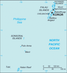
Palau is an Oceanian country located in Micronesia, east of the Philippines, north of Western New Guinea in Indonesia, west of the Federated States of Micronesia and occupying the westernmost tip of the archipelago of Carolinas. The country is divided into sixteen states spread over several hundred islands of which only a few are inhabited.

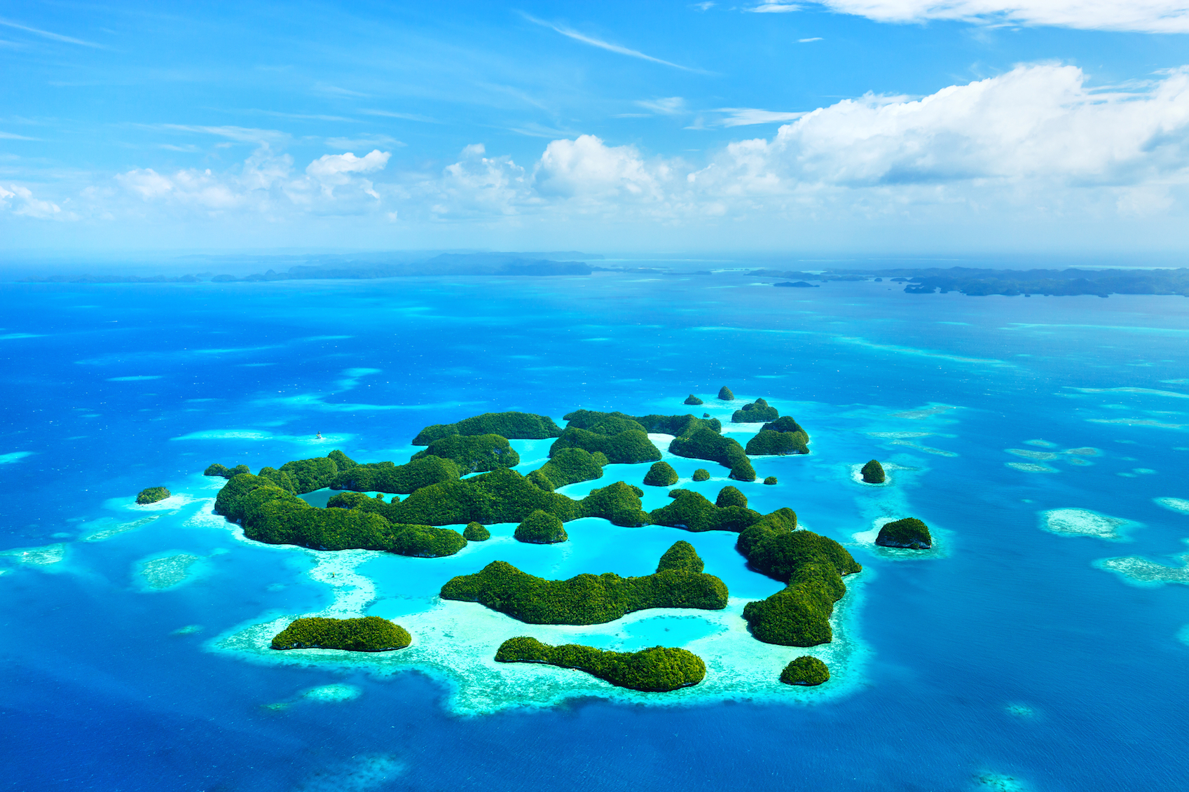
Palau became independent of United States tutelage in 1994, making the archipelago a very young country. Its economic dependence on the United States remains strong, but development is now mainly based on tourism.
The Asia-Pacific region has for decades been growing economically, and thanks to good infrastructure, the country receives more and more tourists from the countries of this region. They come to admire beautiful seabed water that is 29°C all year, and increasingly well preserved by the local population, which sees a real advantage.
Indeed, faced with the rise in sea level, more and more perceptible locally, residents have decided to move forward with a more sustainable development. It remains to be seen if in the long run, this state of mind will continue.

See all related maps or articles
Urban areas (2018)
Urban areasPopulation
Koror11,892 inhabitants
Melekeok257 inhabitants
See all urban areas
Administrative divisions
StatesPopulationArea
Aimeliik334 inhabitants37 km²
Airai2,455 inhabitants49 km²
Angaur119 inhabitants8 km²
Hatohobei25 inhabitants1 km²
Kayangel54 inhabitants2 km²
Koror11,892 inhabitants58 km²
Melekeok257 inhabitants25 km²
Ngaraard413 inhabitants29 km²
Ngarchelong316 inhabitants8 km²
Ngardmau185 inhabitants30 km²
Ngatpang282 inhabitants35 km²
Ngchesar291 inhabitants38 km²
Ngeremlengui350 inhabitants61 km²
Ngiwal282 inhabitants16 km²
Peleliu484 inhabitants17 km²
Sonsorol40 inhabitants3 km²
See all administrative divisions
See also