Secondary Menu
Home
World – Country Profiles
Africa
Americas
Antarctica
Asia
Europe
Oceania
Themes
Demography
Environment
Globalization
Health
Humanitarian
Human Rights
Institutions
Miscellaneous
Poverty
Society
Rankings – All Statistics
Birth Rate
Countries and Territories of the World (Population)
Environmental Performance Index (EPI)
GDP
GDP/Capita
Human Development Index (HDI)
Infant Mortality
Life Expectancy
Mortality
Most Spoken Languages in the World
Tourism
World’s Largest Cities
ImagesSat
Maps
Historical Maps
Lights of the World HD
North Magnetic Pole
Political Map of the World
Time Zone
Tools
List of ISO Codes
Metric System – Imperial System
Periodic Table of Elements
GeoFolios
GeoFolio – Humanitarian
GeoFolio – Nature
GeoFolio – Urbanization
FR
Norway
Map list
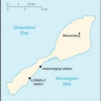
Norvège – Jan Mayen
Source: CIA
See the map
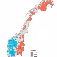
Norvège – langues
Source: Wikipédia
See the map
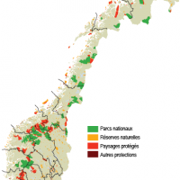
Norvège – parcs nationaux et aires protégées
Source: Statistiques Norvège
See the map
Norvège – petite
Source: CIA
See the map
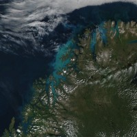
Norvège – phytoplancton vu de l’espace
Source: Nasa Earth Observatory
See the map
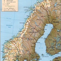
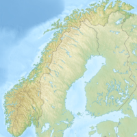
Norvège – relief
Source: CIA
See the map
Norvège – relief
Source: Google Maps
See the map
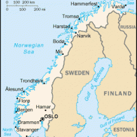
Norvège – routière
Source: Google Maps
See the map
Norvège – satellite
Source: Google Maps
See the map
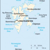
Norvège – Svalbard
Source: CIA
See the map
Norvège – topographique
Source: Wikipédia
See the map
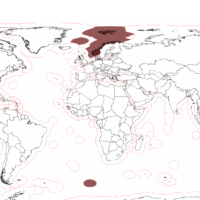
Norvège – zones économiques exclusives
Source: Wikipédia
See the map
Norvège – Svalbard – topographique
Source: Institut polaire norvégien
See the map
Oslo – routière
Source: Google Maps
See the map
Oslo – satellite
Source: Google Maps
See the map
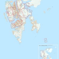
Oslo – zone urbaine
Source: Wikipédia
See the map
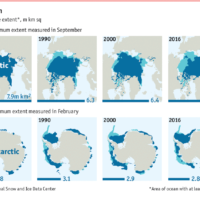
Poles – minimum ice cover (1980-2016)
Source: National Snow and Ice Data Center
See the map
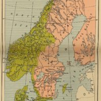
Scandinavia (1520)
Source: Wikipedia
See the map
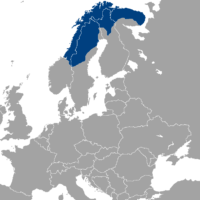
Scandinavia – Sámi people
Source: Wikipedia
See the map
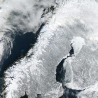
Scandinavia – winter
Source: Wikipedia
See the map
« First
‹ Previous
1
2
3
Next ›
Last »