Gabon November 26, 2020 Africa , African Union , Atlantic Ocean , Central Africa , colony , dictatorship , écotourisme , energy , Equator , forest , French colony , Gabon , Gabonese Republic , Gulf of Guinea , hydrocarbons , jungle , Libreville , national parks , oil , OPEC , Organization of Petroleum Exporting Countries , Port-Gentil , poverty , The Republic of Gabon , tourism Official name Gabonese Republic Name in local language République gabonaise (fr) Continent Africa Subcontinent Sub-Saharan Africa Population (ranking: 154e ) 2,074,656 inhabitants (2020) Population growth 1.96 % / year Area 267,667 km² Density 7.75 inhabitants / km² GDP (ranking: 124e )16.658 billions $USD (2019) GDP/capita (ranking ) 7,667 $USD (2019) GDP growth 3.40 % / year (2019) Life expectancy (ranking ) 66.20 years (2018) Birth rate 30.17 ‰ (2014) Fertility rate 3.91 children / woman (2014) Death rate (ranking ) 8.63 ‰ (2014) Infant mortality rate (ranking ) 36.10 ‰ (2015) Literacy rate 83.18 % (2015) Official languages French Currency Central African CFA franc (XAF) HDI (ranking: 151e )0.702 / 1 (2018) EPI (ranking )45.05 (2018) Government Unitary dominant-party presidential republic (dictatorship in facts) Head of State President Ali Bongo Ondimba National Day 12 March, 17 August (independence of 1960) ISO Codes GA, GAB Demonym Gabonese Tourists (ranking ) 90,000 people (2011)
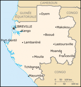
A rich country with a very poor population Gabon is a country in Central Africa. It is bordered by the Atlantic Ocean to the west, Congo to the south and east, Equatorial Guinea to the northwest and Cameroon to the north. Former French colony, Gabon is independent since 1960. It is crossed by the equator.
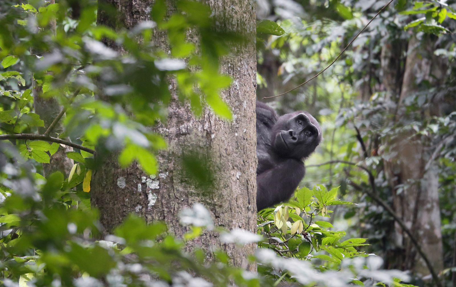
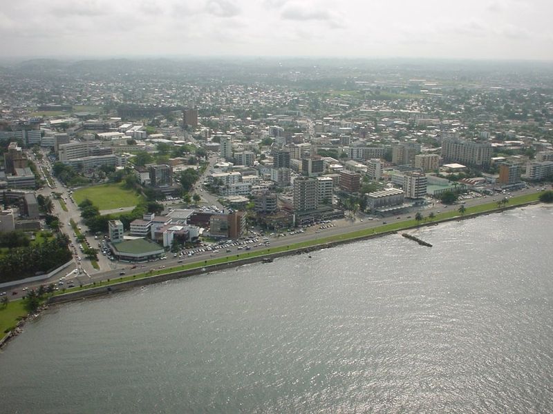
Gorilla, Moukalaba-Doudouk National Park, Gabon. Photo: David Korte. Source: Wildlife Archives Libreville, capitale of Gabon. Photo: Bajan28 Urban areas (2016) Urban areas Population Libreville 967,095 inhabitants Port-Gentil 147,817 inhabitants Franceville (Masuku) 128,729 inhabitants Oyem 71,259 inhabitants Mouanda 68,870 inhabitants Lambaréné 44,249 inhabitants
Administrative divisions Provinces Population Area Estuaire 895,689 inhabitants 20,740 km² Haut-Ogooué 250,799 inhabitants 36,547 km² Moyen-Ogooué 69,287 inhabitants 18,535 km² Ngounié 100,838 inhabitants 37,750 km² Nyanga 52,854 inhabitants 21,285 km² Ogooué-Ivindo 63,293 inhabitants 46,075 km² Ogooué-Lolo 65,771 inhabitants 25,380 km² Ogooué-Maritime 157,562 inhabitants 22,890 km² Woleu-Ntem 154,986 inhabitants 38,465 km²
See also