PopulationData.net

Cameroon

Official name Republic of Cameroon
Name in local language République du Cameroun (fr)
Continent Africa
Subcontinent Sub-Saharan Africa
Population (ranking: 58e) 23,799,022 inhabitants (2018)
Population growth 2.37 % / year
Area 475,650 km²
Density 50.03 inhabitants / km²
GDP (ranking: 100e) 38.502 billions $USD (2018)
GDP/capita (ranking) 1,527 $USD (2018)
GDP growth 3.90 % / year (2018)
Life expectancy (ranking) 58.90 years (2018)
Birth rate 31.93 ‰ (2013)
Fertility rate 4.00 children / woman (2013)
Death rate (ranking) 11.51 ‰ (2013)
Infant mortality rate (ranking) 58.51 ‰ (2013)
Literacy rate 80.57 % (2010)
Official languages French, English
Currency Central African CFA franc (XAF)
HDI (ranking: 188e) 0.563 / 1 (2018)
EPI (ranking) 40.81 (2018)
Government Unitary dominant-party presidential republic (dictatorship de facto)
Head of State President Paul Biya
National Day 20 May (Republic)
ISO Codes CM, CMR
Demonym Cameroonian
Tourists (ranking) 912,000 people (2013)
A country that has assets but does not use them enough

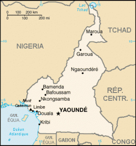
Cameroon is a country in Central and West Africa located in the Gulf of Guinea. It shares borders with Nigeria to the west, Chad to the north, the Central African Republic to the east, Gabon, Equatorial Guinea and Congo to the south.
Former German colony, Cameroon was then placed under half United Kingdom (West), and France (East, North and South) and is now a member of the International Organization of La Francophonie, as well as the British Commonwealth.
Packed with natural resources, including wood and oil, it remains a very poor country. Indeed, its resources are not used fully and especially the revenues do not benefit the entire population. The authorities are corrupt and the democracy of facade hides badly a dictatorship which prevents any contestation by the force.

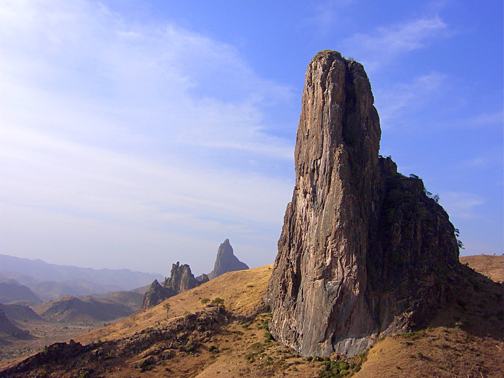
Mount Rhumsiki, North, Cameroon. Source: Wildlife Archives
See all related maps or articles
Urban areas (2015)
Urban areas Population
Douala 2,768,436 inhabitants
Yaoundé 2,765,568 inhabitants
Garoua 546,060 inhabitants
Bamenda 515,593 inhabitants
Maroua 415,251 inhabitants
Bafoussam 365,017 inhabitants
Ngaoundéré 298,016 inhabitants
Bertoua 281,139 inhabitants
Edéa 263,997 inhabitants
Loum 234,471 inhabitants
Mbouda 175,986 inhabitants
Kumba 173,380 inhabitants
Djang 140,861 inhabitants
Nkongsamba 129,168 inhabitants
See all urban areas
Administrative divisions
Regions Population Area
Adamaoua 1,200,970 inhabitants 63,701 km²
Centre 4,159,492 inhabitants 68,953 km²
Est 835,642 inhabitants 109,002 km²
Extrême-Nord 3,993,007 inhabitants 34,263 km²
Littoral 3,354,978 inhabitants 20,248 km²
Nord 2,442,578 inhabitants 66,090 km²
Nord-Ouest 1,968,578 inhabitants 17,300 km²
Ouest 1,921,590 inhabitants 13,892 km²
Sud 749,552 inhabitants 47,191 km²
Sud-Ouest 1,553,320 inhabitants 25,410 km²
See all administrative divisions
See also
Exit mobile version