PopulationData.net

Afghanistan

Official name Islamic Republic of Afghanistan
Name in local language د أفغانستان اسلامي جمهوریت (ps) ; جمهوری اسلامی افغانستان (prs)
Continent Asia
Subcontinent Central Asia
Population (ranking: 41e) 34,233,212 inhabitants (2020)
Population growth 6.23 % / year
Area 652,864 km²
Density 52.44 inhabitants / km²
GDP (ranking: 118e) 19.363 billions $USD (2018)
GDP/capita (ranking) 521 $USD (2018)
GDP growth 1.00 % / year (2018)
Life expectancy (ranking) 64.50 years (2018)
Birth rate 34.22 ‰ (2014)
Fertility rate 4.84 children / woman (2014)
Death rate (ranking) 8.23 ‰ (2014)
Infant mortality rate (ranking) 66.30 ‰ (2015)
Literacy rate 38.16 % (2015)
Official languages Dari, Pachto
Currency Afghani (AFN)
HDI (ranking: 208e) 0.496 / 1 (2018)
EPI (ranking) 37.74 (2018)
Government Unitary presidential Islamic republic
Head of State President Ashraf Ghani
National Day 19 August (independence of 1919)
ISO Codes AF, AFG
Demonym Afghane, Afghan
Tourists (ranking) 20,000 people (2016)
The country is recovering slowly and slowly from several decades of wars

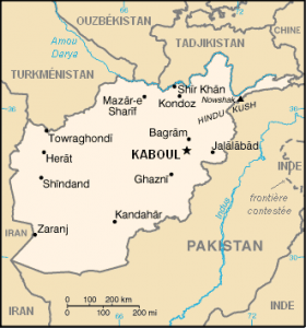
Afghanistan is a landlocked Central Asian country bordered by Pakistan, China, Tajikistan, Turkmenistan, Uzbekistan and Iran.
Since the arrival of the democracy established by force by the international community, the country has undertaken its modernization, that is, its reconstruction. It is slow, the financial means are limited, and the promises of funding from major donor countries have not been fully met.
However, mortality has declined significantly, especially infant mortality, which has been halved, and health and social conditions are improving. Access to drinking water has also increased significantly, from 30.3% in 2000 to 55.3% in 2015.
On the other hand, the increase in the population of large cities, with the arrival of peasants fleeing agricultural areas riddled with anti-personnel mines, is slowing down the country’s economic growth, which is largely based on agriculture.

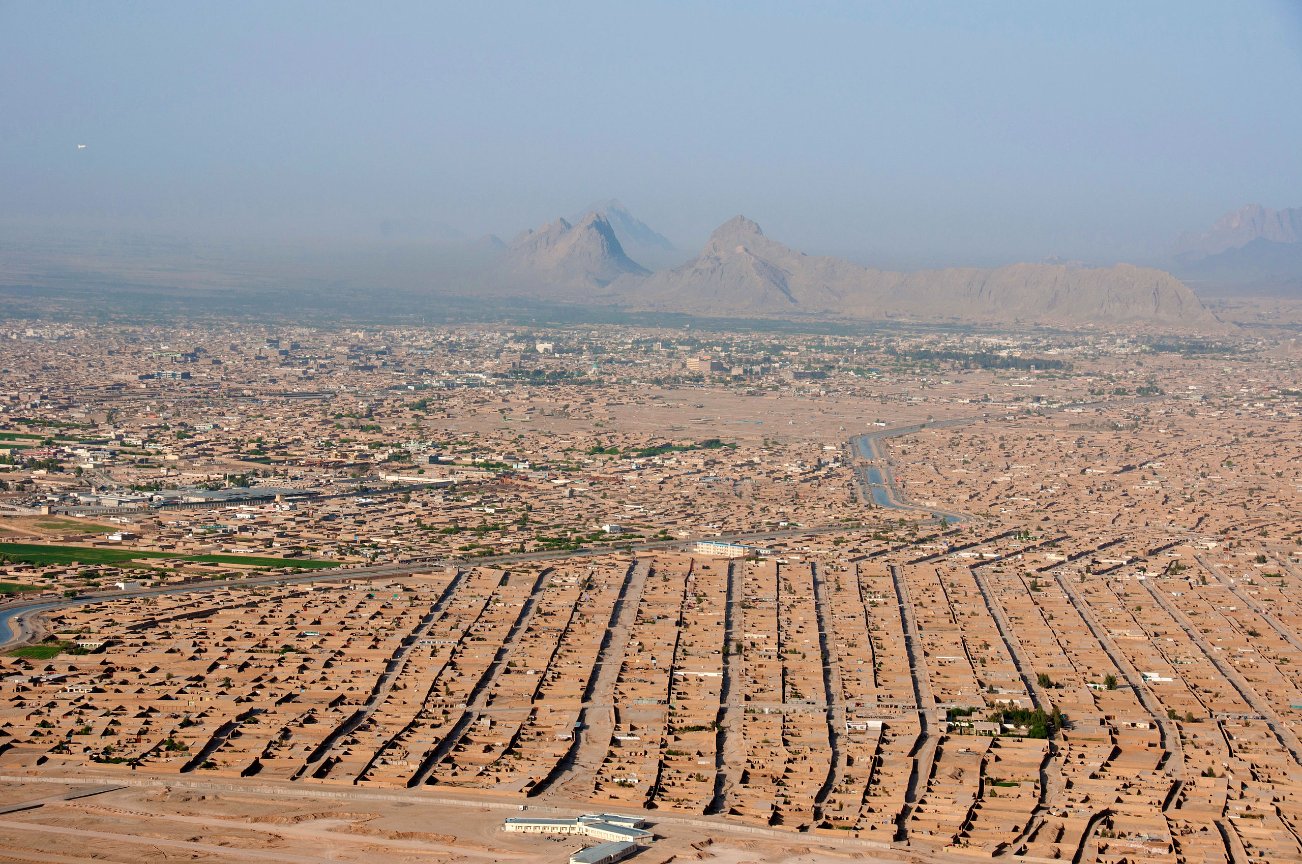
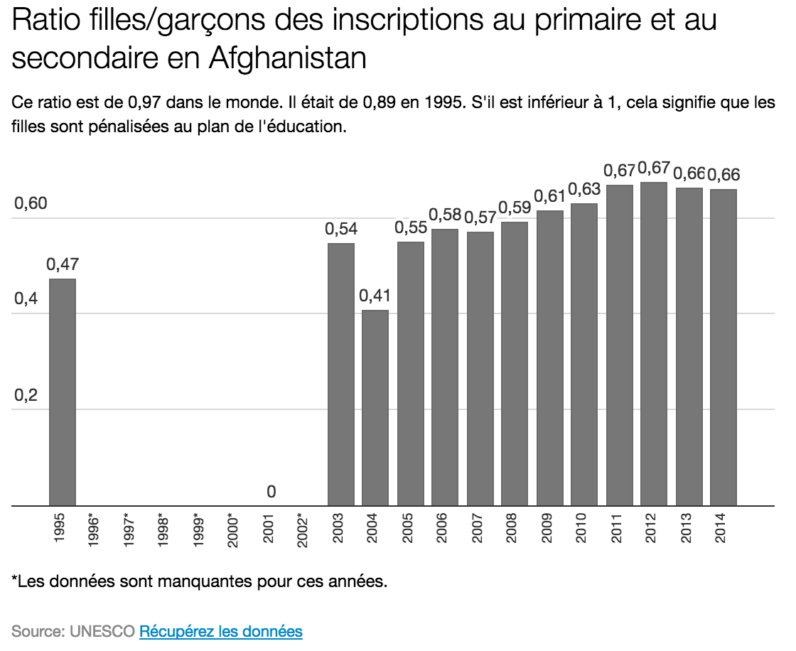
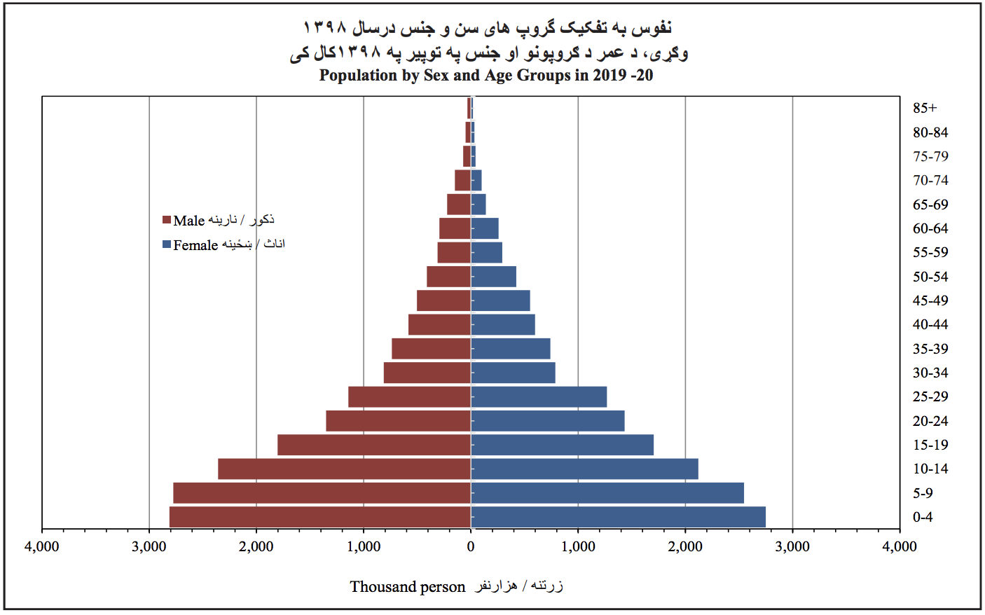
Afghanistan – Kandahar. Photo: Karla Marshall, Wikipedia
Afghanistan – ratio of girls to boys in primary and secondary school
Afghanistan – age structure (2019-2020). Source: Central Statistics Organization of Afghanistan (CSO)
See all related maps or articles
Urban areas (2020)
Urban areas Population
Kabul 5,029,850 inhabitants
Herat 632,206 inhabitants
Mazār-i-Sharīf 567,271 inhabitants
Kandahar 506,794 inhabitants
Jalalabad 232,901 inhabitants
Kunduz 162,168 inhabitants
Khost 143,026 inhabitants
Puli Khumri 110,902 inhabitants
Maimana 86,051 inhabitants
Sheberghan 83,936 inhabitants
Taluqan 75,212 inhabitants
Baghlan 71,379 inhabitants
Ghazni 61,862 inhabitants
Khulm 51,816 inhabitants
See all urban areas
Administrative divisions
Provinces Population Area
Badakhshan 1,035,658 inhabitants 44,836 km²
Badghis 540,009 inhabitants 20,794 km²
Baghlan 995,814 inhabitants 18,255 km²
Balkh 1,475,649 inhabitants 16,186 km²
Bamyan 486,928 inhabitants 18,029 km²
Daykundi 507,610 inhabitants 17,501 km²
Farah 553,058 inhabitants 49,339 km²
Faryab 1,089,228 inhabitants 20,798 km²
Ghazni 1,338,597 inhabitants 22,461 km²
Ghor 751,254 inhabitants 36,657 km²
Helmand 1,420,682 inhabitants 58,305 km²
Herat 2,095,117 inhabitants 55,869 km²
Jowzjan 590,866 inhabitants 11,292 km²
Kabul 5,029,850 inhabitants 4,524 km²
Kandahar 1,368,036 inhabitants 54,845 km²
Kapisa 479,875 inhabitants 1,908 km²
Khost 625,473 inhabitants 4,235 km²
Kunar 490,690 inhabitants 4,926 km²
Kunduz 1,113,676 inhabitants 8,081 km²
Laghman 484,952 inhabitants 3,978 km²
Logar 426,821 inhabitants 4,568 km²
Maidan Wardak 648,866 inhabitants 10,348 km²
Nangarhar 1,668,481 inhabitants 7,641 km²
Nimruz 180,200 inhabitants 42,410 km²
Nuristan 160,993 inhabitants 9,267 km²
See all administrative divisions
See also
Exit mobile version