
| Official name | Islamic Republic of Pakistan |
| Name in local language | اسلامی جمہوریۂ پاکستان ; Islāmī Jumhūrīah Pākistān (ur) ; Islamic Republic of Pakistan (en) |
| Continent | Asia |
| Subcontinent | South Asia |
| Population (ranking: 6e) | 212,761,108 inhabitants (2018) |
| Population growth | 2.40 % / year |
| Area | 796,096 km² |
| Density | 267.25 inhabitants / km² |
| GDP (ranking: 40e) | 312.570 billions $USD (2018) |
| GDP/capita (ranking) | 1,473 $USD (2018) |
| GDP growth | 5.40 % / year (2018) |
| Life expectancy (ranking) | 67.10 years (2018) |
| Birth rate | 26.40 ‰ (2014) |
| Fertility rate | 3.20 children / woman (2014) |
| Death rate (ranking) | 6.90 ‰ (2014) |
| Infant mortality rate (ranking) | 65.80 ‰ (2015) |
| Literacy rate | 73.71 % (2015) |
| Official languages | Urdu, english |
| Currency | Pakistani rupee (₨ PKR) |
| HDI (ranking: 190e) | 0.560 / 1 (2018) |
| EPI (ranking) | 37.50 (2018) |
| Government | Federal parliamentary constitutional republic, Islamic republic |
| Head of State | President Arif Alvi |
| National Day | August 14 (independence of 1947) |
| ISO Codes | PK, PAK |
| Demonym | Pakistani |
| Tourists (ranking) | 6,205 people (2015) |

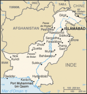
Pakistan is an Islamic Republic of the Indian subcontinent bordered by Iran to the southwest, Afghanistan to the west, China to the north, India to the east, and by the Arabian Sea to the south. It was founded on August 14, 1947 at the end of the partition of the British Indian Empire, in the form of a state consisting of two parts geographically separated by nearly 1600 kilometers of Indian territory, the current Pakistan to the west, and what has become Bangladesh to the east, in the Bay of Bengal. Pakistan was reduced to its western part only after the Bangladesh war of independence in 1971.


Desert of Skardu, Pakistan. Source: Wildlife Archives


Sunset over the countryside, Pakistan. Source: Wildlife Archives

See all related maps or articles
Urban areas (2017)
| Urban areas | Population |
|---|---|
| Karachi | 16,625,813 inhabitants |
| Lahore | 12,328,075 inhabitants |
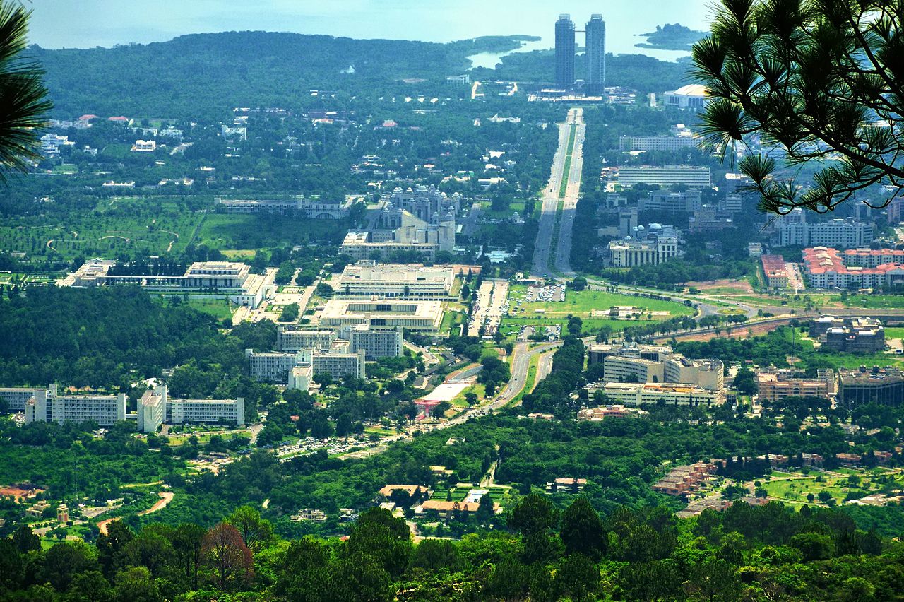
| Islamabad-Rawalpindi | 7,902,211 inhabitants |
| Faisalabad | 7,873,910 inhabitants |
| Moultan (Multan) | 4,745,109 inhabitants |
| Peshawar | 4,269,079 inhabitants |
| Hyderâbâd | 3,192,605 inhabitants |
| Gujranwala | 2,948,936 inhabitants |
| Mardan | 2,373,061 inhabitants |
| Quetta | 2,275,699 inhabitants |
| Sukkur | 1,487,903 inhabitants |
| Abbottabad | 1,332,912 inhabitants |
| Bahawalpur | 1,171,258 inhabitants |
| Sialkot | 1,143,362 inhabitants |
| Sargodha | 1,091,045 inhabitants |
| Rahim Yar Khan | 1,032,636 inhabitants |
| Kohat | 993,874 inhabitants |
| Kasur | 890,835 inhabitants |
| Okara | 831,790 inhabitants |
| Gujrat | 827,396 inhabitants |
| Khairpur | 775,850 inhabitants |
| Larkana | 701,637 inhabitants |
| Mingora | 695,900 inhabitants |
| Muzaffargarh | 694,771 inhabitants |
| Bahawalnagar | 621,096 inhabitants |
See all urban areas
Administrative divisions
| Provinces and territories | Population | Area |
|---|---|---|
| Azad Jammu-et-Cachemire (Azad Jammu and Kashmir) (Territoire) | 4,567,982 inhabitants | 13,297 km² |
| Baloutchistan (Balochistan) | 13,344,408 inhabitants | 347,190 km² |
| Khyber Pakhtunkhwa | 30,523,371 inhabitants | 74,721 km² |
| Pendjab (Punjab) | 110,012,442 inhabitants | 205,345 km² |
| Régions tribales administrées fédéralement (FATA) (Régions tribales) | 5,001,676 inhabitants | 27,220 km² |
| Sind (Sindh) | 47,886,051 inhabitants | 140,914 km² |
| Territoire fédéral d'Islamabad (Territoire) | 2,006,572 inhabitants | 906 km² |
| Territoires du Nord (Gilgit-Baltistan) (Territoire) | 1,801,523 inhabitants | 72,971 km² |