Official name
Burkina Faso
Name in local language
Burkina Faso (fr)
Continent
Africa
Subcontinent
Sub-Saharan Africa
Population (ranking: 61e )
21,510,181 inhabitants (2020)
Population growth
3.07 % / year
Area
270,764 km²
Density
79.44 inhabitants / km²
GDP (ranking: 127e )15.746 billions $USD (2019)
GDP/capita (ranking )
775 $USD (2019)
GDP growth
5.70 % / year (2019)
Life expectancy (ranking )
61.20 years (2018)
Birth rate
40.02 ‰ (2014)
Fertility rate
5.52 children / woman (2014)
Death rate (ranking )
9.56 ‰ (2014)
Infant mortality rate (ranking )
50.90 ‰ (2015)
Literacy rate
52.51 % (2015)
Official languages
French
Currency
West African CFA franc (XOF)
HDI (ranking: 220e )0.434 / 1 (2018)
EPI (ranking )42.83 (2018)
Government
Unitary semi-presidential republic
Head of State
President Roch Marc Christian Kaboré
National Day
11 December (autonomy within the French Community in 1958)
ISO Codes BF, BFA
Demonym
Burkinabè
Tourists (ranking )
143,000 people (2017)
Progress in development but much remains to be done
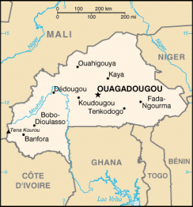
Burkina Faso is a landlocked Francophone West African country, with no access to the sea, surrounded by Mali to the north and west, from Niger to the east, Benin to the southeast, Togo and from Ghana to the south and Ivory Coast to the southwest.
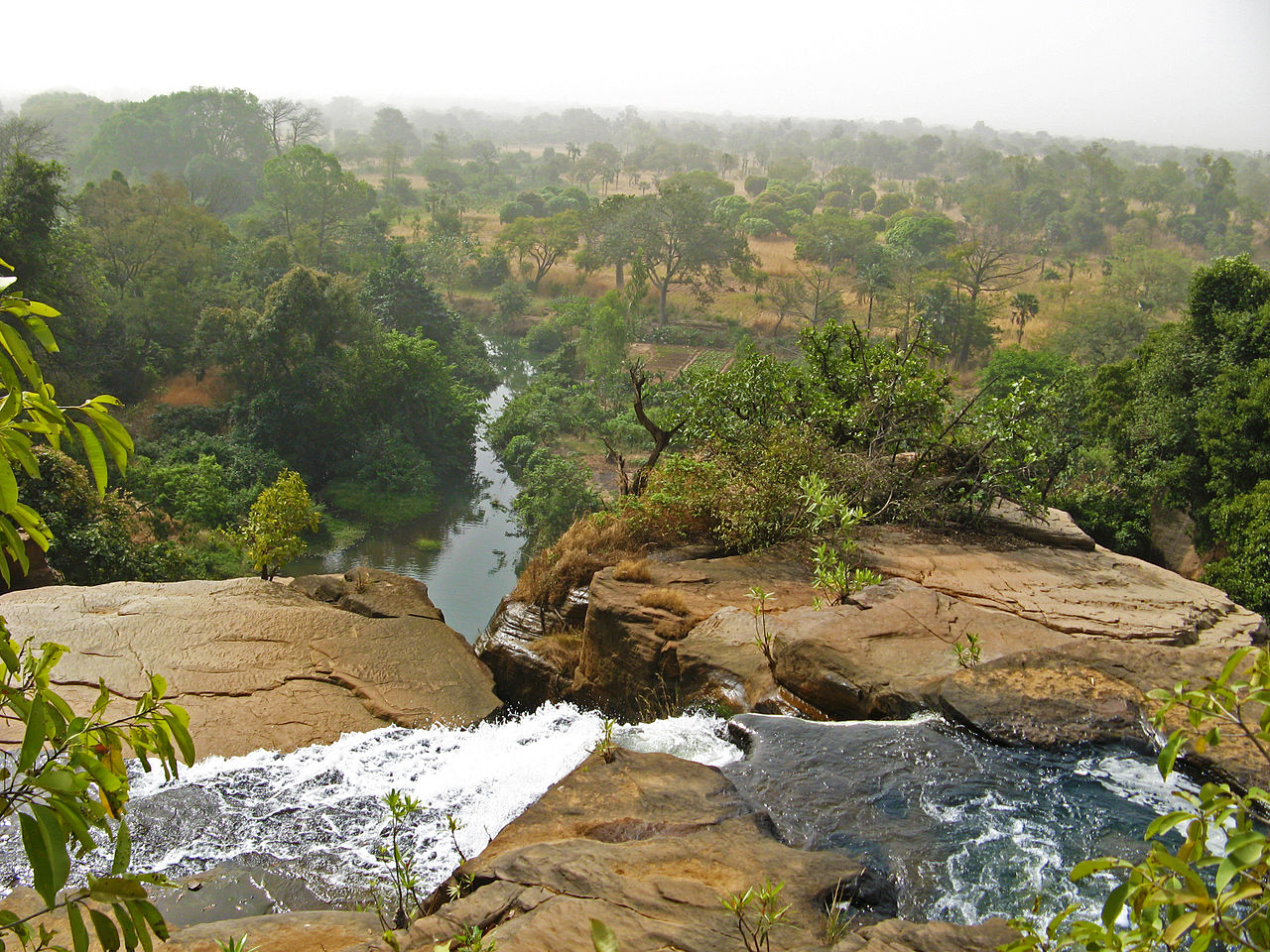
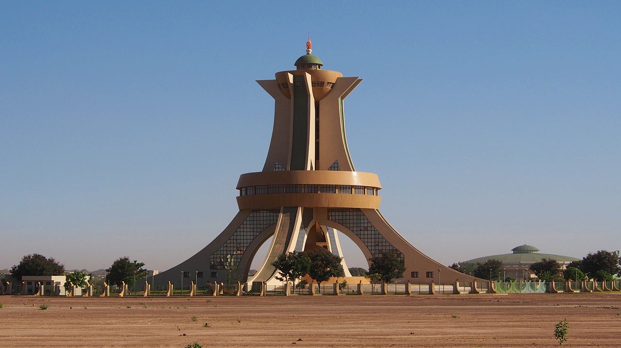
Karfiguela waterfall, Burkina Faso. Photo: Antona Osberg Martyrs Monument, Ouagadougou. Photo: Sputniktilt Urban areas (2019)
Urban areas
Population
Ouagadougou
2,966,307 inhabitants
Bobo-Dioulasso
806,939 inhabitants
Koudougou
183,332 inhabitants
Fada N'Gourma
180,356 inhabitants
Ouahigouya
169,893 inhabitants
Tenkodogo
165,961 inhabitants
Solenzo
163,267 inhabitants
Kaya
162,377 inhabitants
Gorom-Gorom
155,589 inhabitants
Banfora
153,574 inhabitants
Dori
145,764 inhabitants
Pissila
134,087 inhabitants
Bilanga
129,616 inhabitants
Sidéradougou
128,362 inhabitants
Arbinda
125,492 inhabitants
Pouytenga
122,477 inhabitants
Dédougou
118,727 inhabitants
Bogandé
118,154 inhabitants
Houndé
111,650 inhabitants
Gourcy
111,127 inhabitants
Karangasso-Vigué
111,014 inhabitants
Barsalogho
110,382 inhabitants
Boulsa
110,186 inhabitants
Zabré
109,712 inhabitants
Boussouma
109,446 inhabitants
Administrative divisions
Regions
Population
Area
Boucle du Mouhoun
1,777,018 inhabitants
34,497 km²
Cascades
713,059 inhabitants
18,434 km²
Centre
2,966,307 inhabitants
2,805 km²
Centre-Est
1,427,320 inhabitants
14,710 km²
Centre-Nord
1,547,565 inhabitants
20,890 km²
Centre-Ouest
1,468,966 inhabitants
21,726 km²
Centre-Sud
783,430 inhabitants
11,457 km²
Est
1,564,146 inhabitants
46,694 km²
Hauts-Bassins
1,898,361 inhabitants
25,479 km²
Nord
1,502,527 inhabitants
20,410 km²
Plateau-Central
852,536 inhabitants
8,605 km²
Sahel
1,233,559 inhabitants
36,166 km²
Sud-Ouest
773,362 inhabitants
16,318 km²
See also