

| Official name | Federal Republic of Somalia |
| Name in local language | Jamhuuriyadda Federaalka Soomaaliya (so) ; جمهورية الصومال الفدرالية (ar) |
| Continent | Africa |
| Subcontinent | East Africa |
| Population (ranking: 75e) | 13,611,470 inhabitants (2018) |
| Population growth | 2.53 % / year |
| Area | 637,657 km² |
| Density | 21.35 inhabitants / km² |
| GDP (ranking: 163e) | 7.484 billions $USD (2018) |
| GDP/capita (ranking) | 499 $USD (2018) |
| GDP growth | -1.50 % / year (2018) |
| Life expectancy (ranking) | 56.50 years (2015) |
| Birth rate | 43.61 ‰ (2014) |
| Fertility rate | 6.46 children / woman (2014) |
| Death rate (ranking) | 12.03 ‰ (2014) |
| Infant mortality rate (ranking) | 132.50 ‰ (2016) |
| Literacy rate | 37.80 % (2001) |
| Official languages | Somali, Arabic |
| Currency | Somali shilling (SOS) |
| HDI (ranking: 228e) | 0.364 / 1 (2008) |
| EPI (ranking) | 0.00 (2018) |
| Government | Federal parliamentary republic |
| Head of State | President Mohamed Abdullahi Mohamed |
| National Day | 1st July (independence of 1960) |
| ISO Codes | SO, SOM |
| Demonym | Somali |

The government is trying to get things back on track
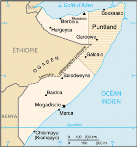
Somalia is a country located at the eastern end of the Horn of Africa, bordered by the Indian Ocean. It shares borders, in its current reduced configuration, with Puntland to the north, Ethiopia to the northwest, and Kenya to the southwest. Formerly the northern part of the country, Somaliland and Puntland are independent in fact.


See all related maps or articles
Urban areas (2010)
| Urban areas | Population |
|---|---|
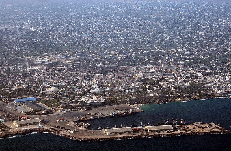
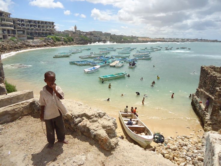
| Mogadiscio | 2,275,976 inhabitants |
| Merka | 480,543 inhabitants |
| Kismaayo | 402,691 inhabitants |
|
Baidoa
Maps:
|
290,750 inhabitants |
| Beledweyne | 200,769 inhabitants |
| Jamaame | 192,719 inhabitants |
| Afgooye | 190,811 inhabitants |
See all urban areas
Administrative divisions
| Regions | Population | Area |
|---|---|---|
| Bakool | 367,226 inhabitants | 26,962 km² |
| Banaadir | 2,275,976 inhabitants | 1,657 km² |
| Basse Shabelle (Shabeellaha Hoose) | 1,202,219 inhabitants | 25,285 km² |
| Bay | 792,182 inhabitants | 35,156 km² |
| Galguduud | 569,434 inhabitants | 46,126 km² |
| Gedo | 508,405 inhabitants | 60,389 km² |
| Haute Juba (Jubbada Dhexe) | 362,921 inhabitants | 9,836 km² |
| Haute Juba (Jubbada Hoose) | 489,307 inhabitants | 42,876 km² |
| Haute Shabelle (Shabeellaha Dhexe) | 516,036 inhabitants | 22,663 km² |
| Hiiraan | 520,685 inhabitants | 31,510 km² |
| Mudug | 717,863 inhabitants | 72,933 km² |