

| Official name | Republic of Côte d'Ivoire |
| Name in local language | Côte d'Ivoire (fr) |
| Continent | Africa |
| Subcontinent | Sub-Saharan Africa |
| Population (ranking: 53e) | 26,491,888 inhabitants (2020) |
| Population growth | 2.59 % / year |
| Area | 322,462 km² |
| Density | 82.16 inhabitants / km² |
| GDP (ranking: 93e) | 43.007 billions $USD (2018) |
| GDP/capita (ranking) | 1,716 $USD (2018) |
| GDP growth | 7.40 % / year (2018) |
| Life expectancy (ranking) | 57.40 years (2018) |
| Birth rate | 35.10 ‰ (2016) |
| Fertility rate | 4.60 children / woman (2016) |
| Death rate (ranking) | 10.40 ‰ (2017) |
| Infant mortality rate (ranking) | 66.90 ‰ (2017) |
| Literacy rate | 50.24 % (2015) |
| Official languages | French |
| Currency | West African CFA franc (XOF) |
| HDI (ranking: 203e) | 0.516 / 1 (2018) |
| EPI (ranking) | 45.25 (2018) |
| Government | Unitary presidential republic under a parliamentary system |
| Head of State | President Alassane Ouattara |
| National Day | 7 December (proclamation of the Republic in 1958 and independence in 1960) |
| ISO Codes | CI, CIV |
| Demonym | Ivorian or Ivoirian |
| Tourists (ranking) | 1,800,000 people (2017) |

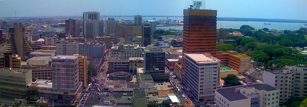
A country in full economic growth
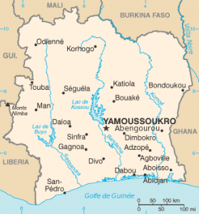
Ivory Coast, or Côte d’Ivoire, is a country in West Africa located along the Gulf of Guinea. It is bordered to the north by Mali and Burkina Faso, to the west by Liberia and Guinea, to the east by Ghana and to the south by the Atlantic Ocean.


Source: Wildlife Archives

See all related maps or articles
Urban areas (2014)
| Urban areas | Population |
|---|---|
| Abidjan | 4,707,404 inhabitants |
| Bouaké | 608,138 inhabitants |
| Daloa | 319,427 inhabitants |
| Yamoussoukro | 310,056 inhabitants |
| Korhogo | 286,071 inhabitants |
| San Pedro | 261,616 inhabitants |
| Gagnoa | 213,918 inhabitants |
| Man | 188,704 inhabitants |
| Divo | 179,455 inhabitants |
| Soubré | 175,163 inhabitants |
| Abengourou | 135,635 inhabitants |
See all urban areas
Administrative divisions
| Districts | Population | Area |
|---|---|---|
| Abidjan (district autonome) | 4,707,404 inhabitants | 2,119 km² |
| Bas-Sassandra | 2,280,548 inhabitants | 25,800 km² |
| Comoé | 1,203,052 inhabitants | 14,173 km² |
| Denguélé | 289,779 inhabitants | 20,997 km² |
| Gôh-Djiboua | 1,605,286 inhabitants | 17,580 km² |
| Lacs | 1,258,604 inhabitants | 28,500 km² |
| Lagunes | 1,478,047 inhabitants | 23,280 km² |
| Montagnes | 2,371,920 inhabitants | 31,050 km² |
| Sassandra-Marahoué | 2,293,304 inhabitants | 23,940 km² |
| Savanes | 1,607,497 inhabitants | 40,323 km² |
| Vallée du Bandama | 1,440,826 inhabitants | 28,518 km² |
| Woroba | 845,139 inhabitants | 31,088 km² |
| Yamoussoukro (district autonome) | 355,573 inhabitants | 3,500 km² |
| Zanzan | 934,352 inhabitants | 38,251 km² |