Official name
Saint Lucia
Name in local language
Saint Lucia (en)
Continent
Americas
Subcontinent
Caribbean
Population (ranking: 200e )
178,696 inhabitants (2018)
Population growth
0.79 % / year
Area
603 km²
Density
296.34 inhabitants / km²
GDP (ranking: 204e )1.876 billions $USD (2018)
GDP/capita (ranking )
10,315 $USD (2018)
GDP growth
0.60 % / year (2018)
Life expectancy (ranking )
76.10 years (2018)
Birth rate
13.50 ‰ (2016)
Fertility rate
1.75 children / woman (2016)
Death rate (ranking )
7.60 ‰ (2016)
Infant mortality rate (ranking )
11.20 ‰ (2016)
Literacy rate
90.10 % (2001)
Official languages
English, Saint Lucian Creole, French
Currency
East Caribbean dollar ($ XCD)
HDI (ranking: 123e )0.745 / 1 (2018)
EPI (ranking )56.18 (2018)
Government
Unitary parliamentary constitutional monarchy
Head of State
Queen Elizabeth II ; Governor-General Neville Cenac
National Day
13 December
ISO Codes LC, LCA
Demonym
Saint Lucian
Tourists (ranking )
1,114,756 people (2017)
An island that lives thanks to tourism
St. Lucia is an island nation in the Caribbean, located on the eastern edge of the Caribbean Sea. It is part of the Windward Islands between Saint Vincent and the Grenadines to the south, Barbados to the southeast and Martinique to the north. Saint Lucia is also part of the British Commonwealth. Small island near Martinique, the official language is English, but it speaks a lot French and Creole.
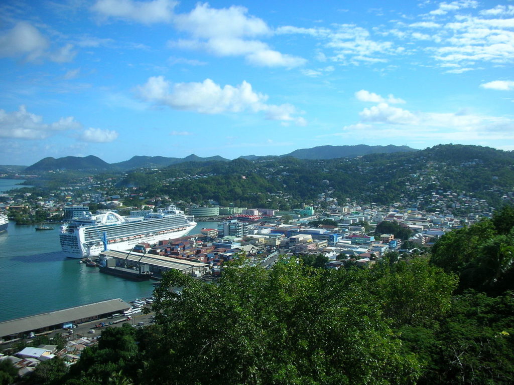
Castries, capital of Saint Lucia. Photo: UpstateNYer Urban areas (2017)
Urban areas
Population
Castries
106,466 inhabitants
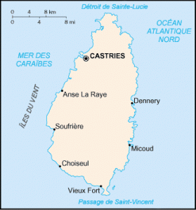
Administrative divisions
Quarters
Population
Area
Anse-la-Raye
6,305 inhabitants
31 km²
Canaries
2,063 inhabitants
16 km²
Castries
66,262 inhabitants
80 km²
Choiseul
6,154 inhabitants
31 km²
Dennery
12,715 inhabitants
70 km²
Forest
0 inhabitants
78 km²
Gros-Islet
25,443 inhabitants
101 km²
Laborie
6,763 inhabitants
38 km²
Micoud
16,434 inhabitants
78 km²
Soufrière
8,550 inhabitants
50 km²
Vieux Fort
16,434 inhabitants
44 km²
See also