PopulationData.net

Cape Verde

Official name Republic of Cabo Verde
Name in local language República de Cabo Verde (pt) ; Repúblika di Kabu Verdi (kea)
Continent Africa
Subcontinent Sub-Saharan Africa
Population (ranking: 178e) 544,081 inhabitants (2018)
Population growth 1.19 % / year
Area 4,033 km²
Density 134.91 inhabitants / km²
GDP (ranking: 198e) 1.987 billions $USD (2018)
GDP/capita (ranking) 3,654 $USD (2018)
GDP growth 5.50 % / year (2018)
Life expectancy (ranking) 76.20 years (2017)
Birth rate 19.89 ‰ (2017)
Fertility rate 2.29 children / woman (2017)
Death rate (ranking) 4.90 ‰ (2013)
Infant mortality rate (ranking) 21.40 ‰ (2013)
Literacy rate 98.34 % (2015)
Official languages Portuguese
Currency Cape Verdean escudo (CVE)
HDI (ranking: 164e) 0.651 / 1 (2018)
EPI (ranking) 56.94 (2018)
Government Unitary semi-presidential republic
Head of State President Jorge Carlos Fonseca
National Day 5 July (independence of 1975)
ISO Codes CV, CPV
Demonym Cape Verdean, Cabo Verdean
Tourists (ranking) 668,000 people (2017)

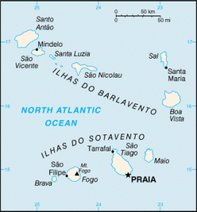
Cape Verde (or Cabo Verde) is an island country in West Africa composed of an archipelago of ten volcanic islands. It is located in the Atlantic Ocean, off the coast of Mauritania and Senegal. The archipelago is divided into two series of islands: to the south the islands of Sotavento (Brava, Fogo, Santiago and Maio) and to the north the islands of Barlavento (Boa Vista, Sal, Sao Nicolau, Santa Luzia, São Vicente and Santo Antao). Santiago alone comprises more than half of the country’s population, including the capital and largest city Praia. The country is a former colony of Portugal, which became independent on July 5, 1975.

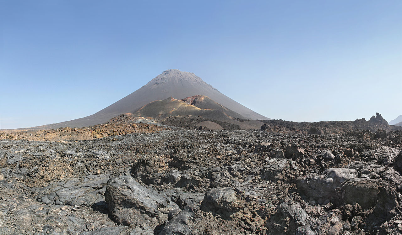
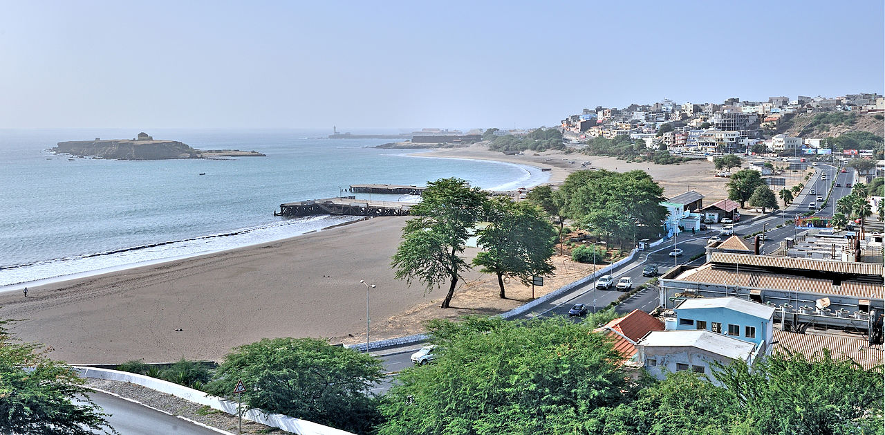
Fogo Peak, Cape Verde Volcano. Photo: Simo Räsänen
Praia, capitale of Cape Verde. Photo: Cayambe
See all related maps or articles
Urban areas (2017)
Urban areas Population
Praia 159,047 inhabitants
Mindelo 82,680 inhabitants
See all urban areas
Administrative divisions
Islands Population Area
Boa Vista 16,621 inhabitants 620 km²
Brava 5,579 inhabitants 64 km²
Fogo 35,416 inhabitants 476 km²
Maio 7,111 inhabitants 269 km²
Sal 36,769 inhabitants 216 km²
Santa Luzia 0 inhabitants 35 km²
Santiago 301,903 inhabitants 991 km²
Santo Antão 39,324 inhabitants 779 km²
São Nicolau 12,260 inhabitants 343 km²
São Vicente 82,680 inhabitants 227 km²
See all administrative divisions
See also
Exit mobile version