PopulationData.net

Bangladesh

Official name People's Republic of Bangladesh
Name in local language গণপ্রজাতন্ত্রী বাংলাদেশ - Gaṇaprajātantrī Bāṃlādēśa (bn)
Continent Asia
Subcontinent South Asia
Population (ranking: 8e) 173,548,302 inhabitants (2018)
Population growth 2.77 % / year
Area 147,570 km²
Density 1,176.04 inhabitants / km²
GDP (ranking: 43e) 274.025 billions $USD (2018)
GDP/capita (ranking) 1,698 $USD (2018)
GDP growth 7.90 % / year (2018)
Life expectancy (ranking) 72.30 years (2018)
Birth rate 22.07 ‰ (2013)
Fertility rate 2.50 children / woman (2013)
Death rate (ranking) 5.67 ‰ (2013)
Infant mortality rate (ranking) 47.30 ‰ (2013)
Literacy rate 61.55 % (2015)
Official languages Bengali
Currency Taka (৳ BDT)
HDI (ranking: 173e) 0.614 / 1 (2018)
EPI (ranking) 29.56 (2018)
Government Unitary parliamentary republic
Head of State President Abdul Hamid
National Day 26 March (Republic of 1971)
ISO Codes BD, BGD
Demonym Bangladeshi
Tourists (ranking) 125,000 people (2014)
Bangladesh is a victim of its geography

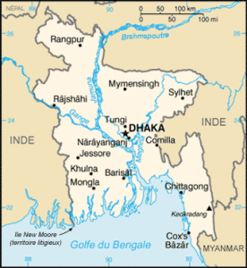
Bangladesh is a South Asian country that is part of the Indian subcontinent. Located in the north of the Bay of Bengal, almost enclaved in India, it also has a small border with Burma.

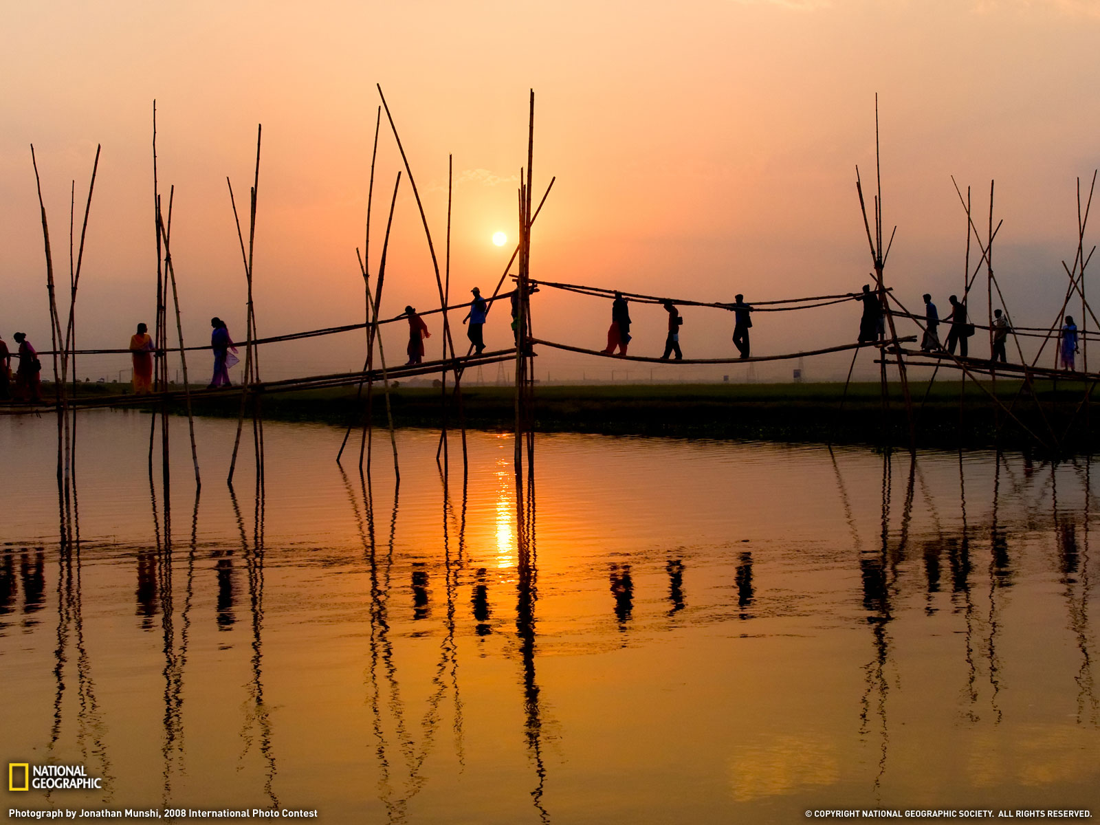
Pedestrian bridge, Bangladesh. Photo: Jonathan Munshi, National Geographic
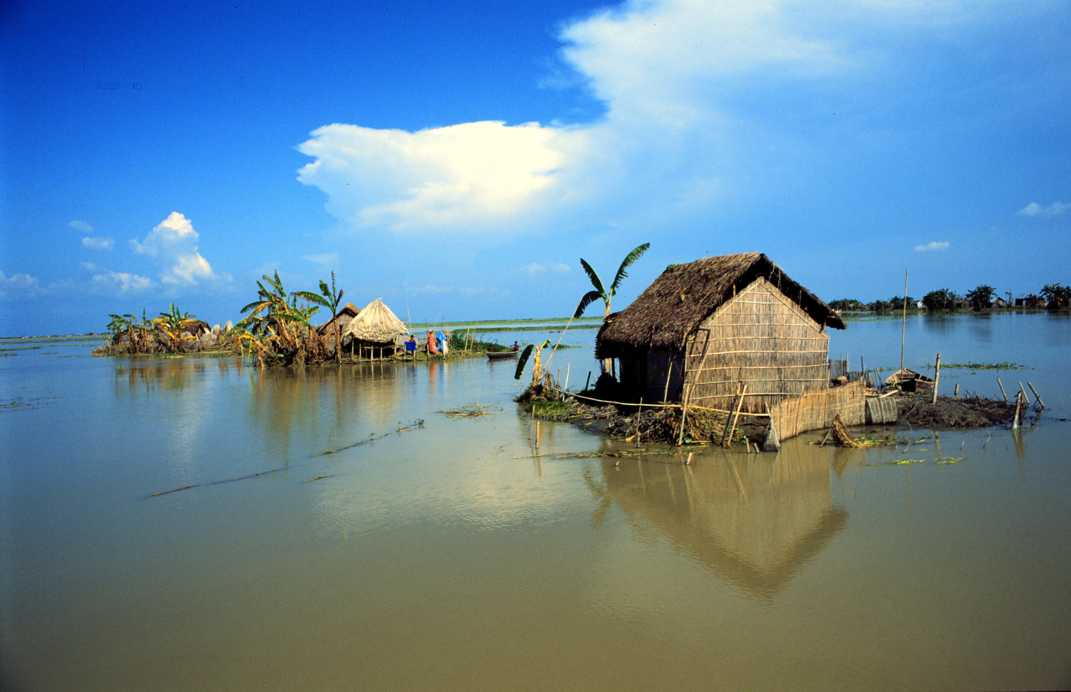
The repeated floods that are swamping the country are the cause of growing underdevelopment. The geographical situation favors this, with the meeting of two of the largest rivers in the world, the Ganges and the Brahmaputra.
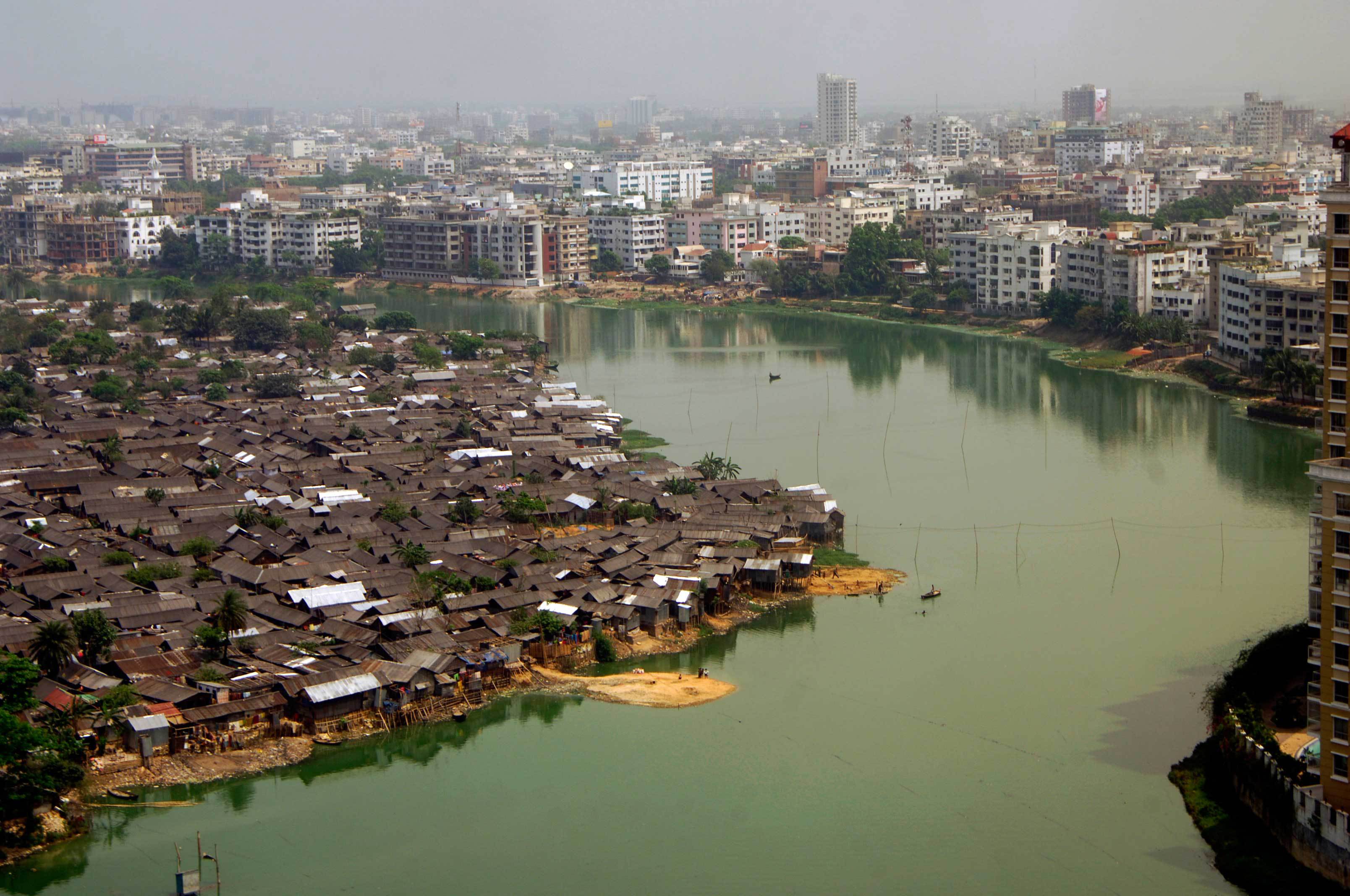
The country can not get out of this perpetual crisis. The majority of the territory is subject to flooding, even though the population density of 1,144 inhabitants per km2 is the largest in the world, with the exception of micro-states. The countryside is more densely populated than some cities in the United States!
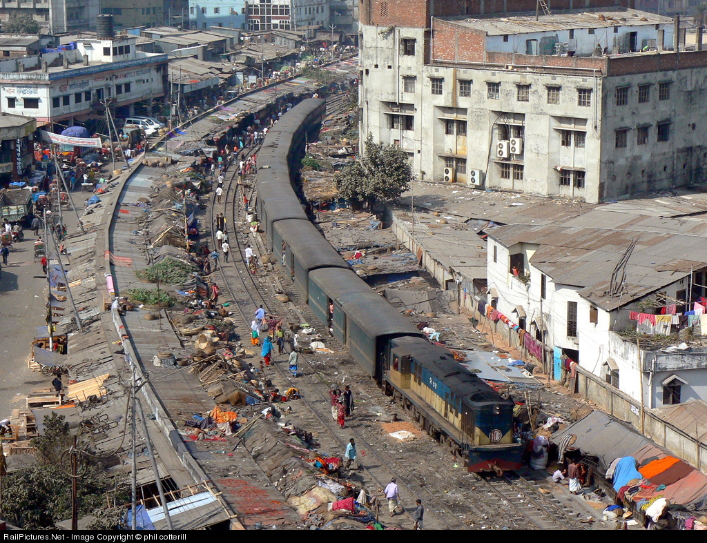
Flooding in Bangladesh
Dhaka, Bangladesh
Train in Dhaka, Bangladesh. Photo: Phil Cotterhill
See all related maps or articles
Urban areas (2017)
Urban areas Population
Dhaka 18,615,648 inhabitants
Chittagong 4,119,026 inhabitants
Khulna 1,611,731 inhabitants
Râjshâhî 878,471 inhabitants
Rangpur 649,865 inhabitants
Sylhet 526,412 inhabitants
Comilla 419,623 inhabitants
Tongi 406,420 inhabitants
Bogra 400,983 inhabitants
Mymensingh 389,918 inhabitants
Barisal 385,093 inhabitants
Narsingdi 292,838 inhabitants
Jessore 250,065 inhabitants
Brahmanbaria 248,942 inhabitants
Cox's Bazar 223,522 inhabitants
Dinajpur 216,066 inhabitants
Gazipur 213,061 inhabitants
Naogaon 208,304 inhabitants
Tangail 189,925 inhabitants
Chapai Nawabganj 180,731 inhabitants
Sirajganj 177,326 inhabitants
Chandpur 171,065 inhabitants
Feni 156,971 inhabitants
Jamalpur 150,172 inhabitants
Pabna 144,442 inhabitants
See all urban areas
Administrative divisions
Divisions Population Area
Barisâl 8,325,666 inhabitants 13,645 km²
Chittagong 28,423,019 inhabitants 33,771 km²
Dhâkâ 36,433,505 inhabitants 20,509 km²
Khulnâ 15,687,759 inhabitants 22,285 km²
Mymensingh 10,990,913 inhabitants 10,584 km²
Râjshâhî 18,484,858 inhabitants 18,310 km²
Rangpur 15,787,758 inhabitants 16,185 km²
Sylhet 9,910,219 inhabitants 12,596 km²
See all administrative divisions
See also
Exit mobile version