Secondary Menu
Home
World – Country Profiles
Africa
Americas
Antarctica
Asia
Europe
Oceania
Themes
Demography
Environment
Globalization
Health
Humanitarian
Human Rights
Institutions
Miscellaneous
Poverty
Society
Rankings – All Statistics
Birth Rate
Countries and Territories of the World (Population)
Environmental Performance Index (EPI)
GDP
GDP/Capita
Human Development Index (HDI)
Infant Mortality
Life Expectancy
Mortality
Most Spoken Languages in the World
Tourism
World’s Largest Cities
ImagesSat
Maps
Historical Maps
Lights of the World HD
North Magnetic Pole
Political Map of the World
Time Zone
Tools
List of ISO Codes
Metric System – Imperial System
Periodic Table of Elements
GeoFolios
GeoFolio – Humanitarian
GeoFolio – Nature
GeoFolio – Urbanization
FR
French Southern and Antarctic Lands (TAAF)
Map list
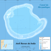
Bassas da India
Source: Wikipédia
See the map
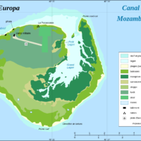
Europa
Source: Wikipédia
See the map
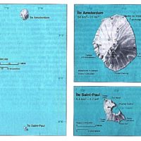
France – Îles Amsterdam et Saint-Paul
Source: Wikipédia
See the map
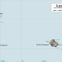
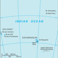
France – Îles Crozet
Source: Wikipédia
See the map
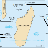
France – îles Éparses de l’océan Indien
Source: Wikipédia
See the map
France – Kerguelen topographic
Source: Wikipedia
See the map
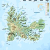
France – Terres australes et antarctiques françaises (TAAF)
Source: Wikipédia
See the map
France – Terres australes et antarctiques françaises (TAAF)
Source: Wikipédia
See the map
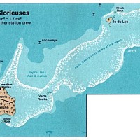
Glorieuses
Source: CIA
See the map
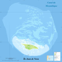
Juan de Nova
Source: Wikipédia
See the map
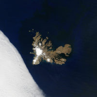
Kerguelen – satellite
Source: NASA
See the map
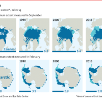
Poles – minimum ice cover (1980-2016)
Source: National Snow and Ice Data Center
See the map
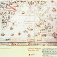
Terre australe (1550)
Source: Sunmap
See the map
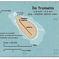
Tromelin
Source: CIA
See the map
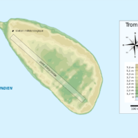
Tromelin – topographic
Source: Wikipedia
See the map