Secondary Menu
Home
World – Country Profiles
Africa
Americas
Antarctica
Asia
Europe
Oceania
Themes
Demography
Environment
Globalization
Health
Humanitarian
Human Rights
Institutions
Miscellaneous
Poverty
Society
Rankings – All Statistics
Birth Rate
Countries and Territories of the World (Population)
Environmental Performance Index (EPI)
GDP
GDP/Capita
Human Development Index (HDI)
Infant Mortality
Life Expectancy
Mortality
Most Spoken Languages in the World
Tourism
World’s Largest Cities
ImagesSat
Maps
Historical Maps
Lights of the World HD
North Magnetic Pole
Political Map of the World
Time Zone
Tools
List of ISO Codes
Metric System – Imperial System
Periodic Table of Elements
GeoFolios
GeoFolio – Humanitarian
GeoFolio – Nature
GeoFolio – Urbanization
FR
Denmark
Map list
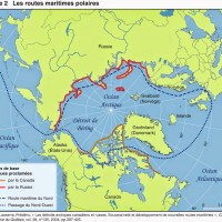
Arctic – Polar sea routes
Source: Cahiers de géographie du Québec, Frédéric Lasserre
See the map
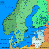
Baltic Sea
Source: Wikipedia
See the map
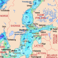
Baltic Sea – bathymetry
Source: Wikipedia
See the map
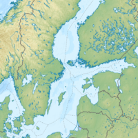
Baltic Sea – topographic
Source: Wikipedia
See the map
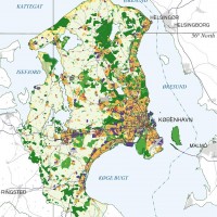
Copenhague – métropole
Source: CIA
See the map
Copenhague – routière
Source: Google Maps
See the map
Copenhague-Malmö – satellite
Source: Google Maps
See the map
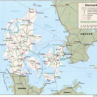
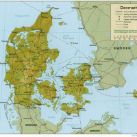
Danemark
Source: CIA
See the map
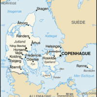
Danemark – petite
Source: Wikipédia
See the map
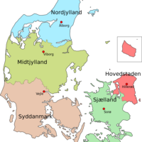
Danemark – régions
See the map
Danemark – relief
Source: CIA
See the map
Danemark – relief
Source: Google Maps
See the map
Danemark – routière
Source: Google Maps
See the map
Danemark – satellite
Source: Google Maps
See the map
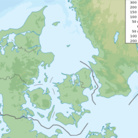
Denmark – topographic
Source: Wikipedia
See the map
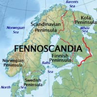
Fennoscandia
Source: Wikipedia
See the map
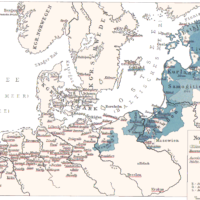
Hanse (Hanseatic League) and State of the Teutonic Order (1300-1400)
Source: Wikipedia
See the map
Malmö – routière
Source: Google Maps
See the map
NATO – Member Countries
Source: Wikipedia
See the map
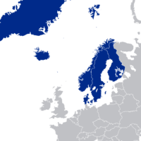
Nordic Council
Source: Wikipedia
See the map
1
2
Next ›
Last »