Secondary Menu
Home
World – Country Profiles
Africa
Americas
Antarctica
Asia
Europe
Oceania
Themes
Demography
Environment
Globalization
Health
Humanitarian
Human Rights
Institutions
Miscellaneous
Poverty
Society
Rankings – All Statistics
Birth Rate
Countries and Territories of the World (Population)
Environmental Performance Index (EPI)
GDP
GDP/Capita
Human Development Index (HDI)
Infant Mortality
Life Expectancy
Mortality
Most Spoken Languages in the World
Tourism
World’s Largest Cities
ImagesSat
Maps
Historical Maps
Lights of the World HD
North Magnetic Pole
Political Map of the World
Time Zone
Tools
List of ISO Codes
Metric System – Imperial System
Periodic Table of Elements
GeoFolios
GeoFolio – Humanitarian
GeoFolio – Nature
GeoFolio – Urbanization
FR
Colombia
Map list
Barranquilla – routière
Source: Google Maps
See the map
Barranquilla – satellite
Source: Google Maps
See the map
Bogotá – aire urbaine
Source: Wikipédia
See the map
Bogotá – routière
Source: Google Maps
See the map
Bogota – satellite
Source: Google Maps
See the map
Bucaramanga – routière
Source: Google Maps
See the map
Bucaramanga – satellite
Source: Google Maps
See the map
Cali – routière
Source: Google Maps
See the map
Cali – satellite
Source: Google Maps
See the map
Carthagène des Indes – routière
Source: Google Maps
See the map
Carthagène des Indes – satellite
Source: Google Maps
See the map
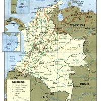
Colombia
Source: CIA
See the map
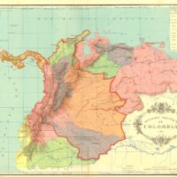
Colombia (1824)
Source: Wikipedia
See the map
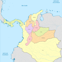
Colombia (1886)
Source: Wikipedia
See the map
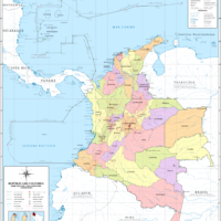
Colombia – administrative
Source: Wikipedia
See the map
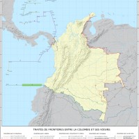
Colombia – borders
Source: National Administrative Department of Statistics of Colombia
See the map
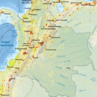
Colombia – coca cultivation
Source: CIA
See the map
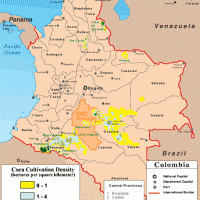
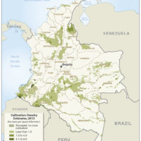
Colombia – coca: cultivation (2013)
Source: UN
See the map
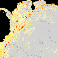
Colombia – density
Source: National Administrative Department of Statistics of Colombia
See the map
Colombia – density (2007)
Source: Wikipedia
See the map
1
2
3
Next ›
Last »