Secondary Menu
Home
World – Country Profiles
Africa
Americas
Antarctica
Asia
Europe
Oceania
Themes
Demography
Environment
Globalization
Health
Humanitarian
Human Rights
Institutions
Miscellaneous
Poverty
Society
Rankings – All Statistics
Birth Rate
Countries and Territories of the World (Population)
Environmental Performance Index (EPI)
GDP
GDP/Capita
Human Development Index (HDI)
Infant Mortality
Life Expectancy
Mortality
Most Spoken Languages in the World
Tourism
World’s Largest Cities
ImagesSat
Maps
Historical Maps
Lights of the World HD
North Magnetic Pole
Political Map of the World
Time Zone
Tools
List of ISO Codes
Metric System – Imperial System
Periodic Table of Elements
GeoFolios
GeoFolio – Humanitarian
GeoFolio – Nature
GeoFolio – Urbanization
FR
Bangladesh
Map list
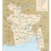
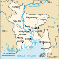
Bangladesh
Source: CIA
See the map
Bangladesh – administrative
Source: Wikipédia
See the map
Bangladesh – densité (2007)
Source: UNOSAT
See the map
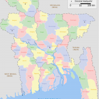
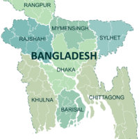
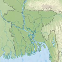
Bangladesh – divisions
Source: Wikipedia
See the map
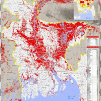
Bangladesh – inondations (août 2007)
Source: UNOSAT
See the map
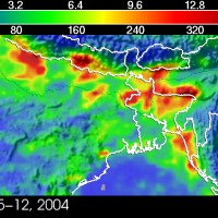
Bangladesh – inondations (juillet 2004)
See the map
Bangladesh – petite
Source: CIA
See the map
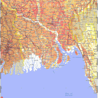
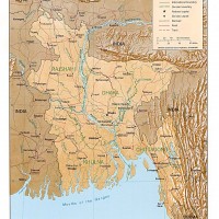
Bangladesh – relief
Source: CIA
See the map
Bangladesh – routière
Source: Google Maps
See the map
Bangladesh – satellite
Source: Google Maps
See the map
Bangladesh – topographic
Source: Wikipedia
See the map
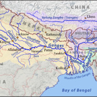
China – India – Bangladesh: Brahmaputra and Ganges Rivers
Source: Wikipedia
See the map
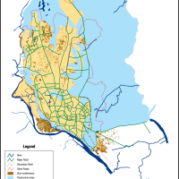
Chittagong – road map
Source: Google Maps
See the map
Chittagong – satellite
Source: Google Maps
See the map
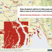
Dhaka – Bangladesh: Rising waters
Source: University of Arizona / Business Insider
See the map
Dhaka – flood zones
Source: UN-Habitat
See the map
Dhaka – road map
Source: Google Maps
See the map
Dhaka – satellite
Source: Google Maps
See the map
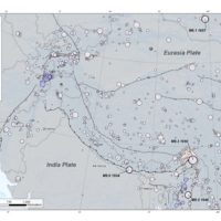
Himalayas – Earthquakes (1900-2016)
Source: USGS
See the map
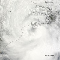
Inde – Bangladesh : cyclone Aila (25 mai 2009)
Source: Nasa Earth Observatory
See the map
1
2
Next ›
Last »