Secondary Menu
Home
World – Country Profiles
Africa
Americas
Antarctica
Asia
Europe
Oceania
Themes
Demography
Environment
Globalization
Health
Humanitarian
Human Rights
Institutions
Miscellaneous
Poverty
Society
Rankings – All Statistics
Birth Rate
Countries and Territories of the World (Population)
Environmental Performance Index (EPI)
GDP
GDP/Capita
Human Development Index (HDI)
Infant Mortality
Life Expectancy
Mortality
Most Spoken Languages in the World
Tourism
World’s Largest Cities
ImagesSat
Maps
Historical Maps
Lights of the World HD
North Magnetic Pole
Political Map of the World
Time Zone
Tools
List of ISO Codes
Metric System – Imperial System
Periodic Table of Elements
GeoFolios
GeoFolio – Humanitarian
GeoFolio – Nature
GeoFolio – Urbanization
FR
Armenia
Map list
Armenia (1000)
Source: Wikipedia
See the map
Armenia – cities
Source: Wikipedia
See the map
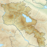
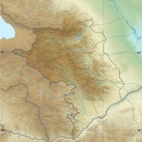
Armenia – topographic
Source: Wikipedia
See the map
Armenia – topographic
Source: Wikipedia
See the map
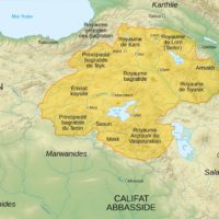
Armenian Kingdom of Cilicia (1199-1375)
Source: Wikipedia
See the map
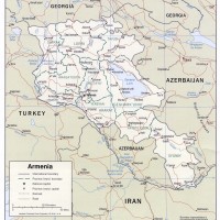
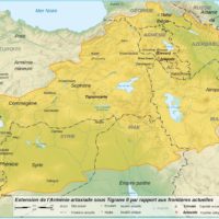
Arménie
Source: CIA
See the map
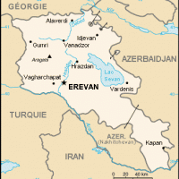
Arménie – petite
Source: Wikipédia
See the map
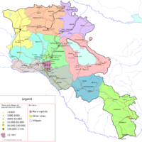
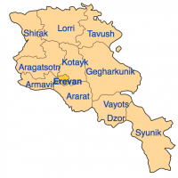
Arménie – régions
Source: Wikipédia
See the map
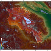
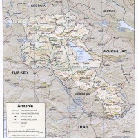
Arménie – relief
Source: CIA
See the map
Arménie – routière
Source: Google Maps
See the map
Arménie – satellite
Source: Google Maps
See the map
Artaxiad Armenia under Tigranes II (80 BC)
Source: Wikipedia
See the map
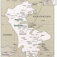
Artsakh (Haut-Karabakh)
Source: CIA
See the map
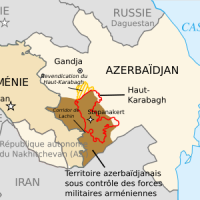
Artsakh (Haut-Karabakh) – occupation militaire
Source: Wikipédia
See the map
Artsakh (Haut-Karabakh) – situation (2012)
Source: Le Monde Diplomatique
See the map
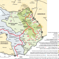
Artsakh (Haut-Karabakh) – topographique
Source: Wikipédia
See the map
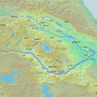
Caucasus – Aras and Kura rivers watershed
Source: Wikipedia
See the map
Caucasus – Drainage basins
Source: Wikipedia
See the map
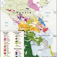
Caucasus – Ethnic groups
Source: CIA
See the map
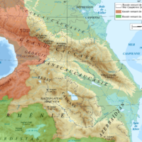
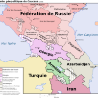
Caucasus – Political
Source: Wikipedia
See the map
1
2
Next ›
Last »