Bhutan March 21, 2020 Asia , Bhutan , bouddhisme , British colony , China , Chomolhari , colony , glaciers , Himalayas , hindouisme , India , Jhomo Lhari , Jomolhari , landlocked country , monarchy , mountains , religion , South Asia , Thimphou , Tibet Official name Kingdom of Bhutan Name in local language Druk Yul - འབྲུག་རྒྱལ་ཁབ་ (dz) Continent Asia Subcontinent South Asia Population (ranking: 143e ) 2,788,599 inhabitants (2018) Population growth 1.52 % / year Area 38,394 km² Density 72.63 inhabitants / km² GDP (ranking: 185e )2.535 billions $USD (2018) GDP/capita (ranking ) 3,360 $USD (2018) GDP growth 2.30 % / year (2018) Life expectancy (ranking ) 71.50 years (2018) Birth rate 17.50 ‰ (2016) Fertility rate 1.93 children / woman (2016) Death rate (ranking ) 6.60 ‰ (2016) Infant mortality rate (ranking ) 33.90 ‰ (2016) Literacy rate 71.40 % (2017) Official languages Dzongkha Currency Ngultrum (BTN) HDI (ranking: 172e )0.617 / 1 (2018) EPI (ranking )47.22 (2018) Government Unitary parliamentary constitutional monarchy Head of State King Jigme Khesar Namgyel Wangchuck National Day 17 December (House of Wangchuck in 1907) ISO Codes BT, BTN Demonym Bhutanese Tourists (ranking ) 255,000 people (2017)
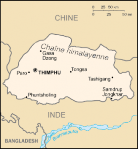
Bhutan is a Southeast Asian country without access to the sea . It is located in the eastern Himalayas, landlocked between India to the south, east and west, and China (Tibet Autonomous Region) to the north. Further west, it is separated from Nepal by the Indian state of Sikkim, and further south it is separated from Bangladesh by the Indian states of Assam and West Bengal. Its capital and largest city is Thimphu.
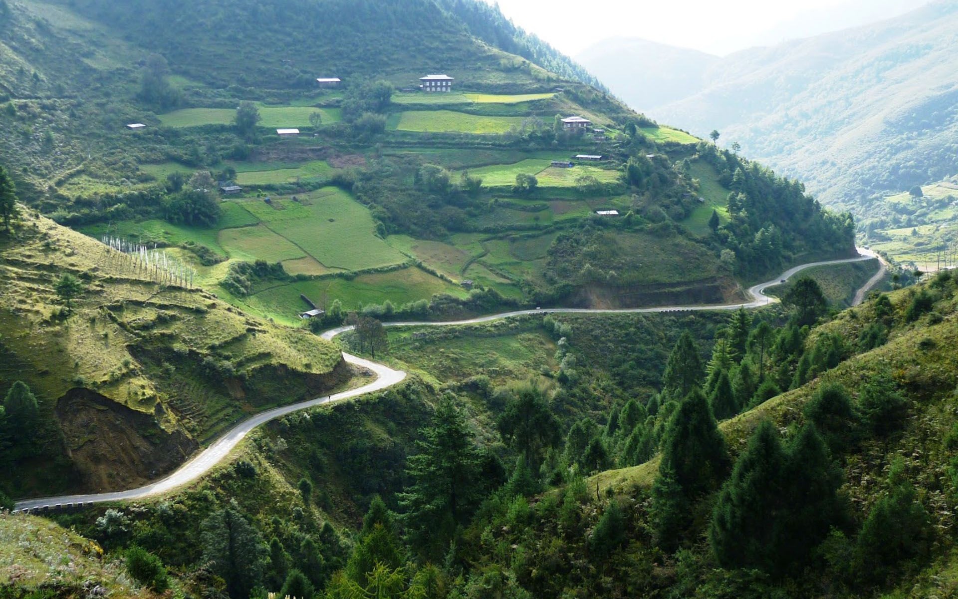
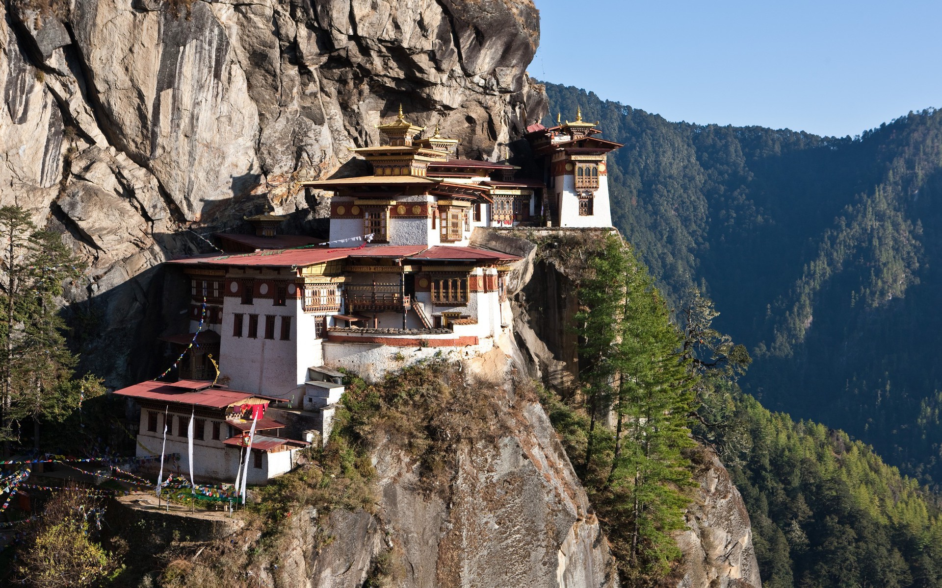
Valley, Bhutan Thimphu, capitale of Bhutan. Photo: Gyzuh Taktshang, monastery in Bhutan Attention: the figures of administrative divisions are those “official”, so without the inhabitants of Nepalese origin, the latter not being officially counted.
Urban areas (2017) Urban areas Population Thimphou 138,720 inhabitants Phuntsholing 125,985 inhabitants
Administrative divisions Districts (Dzongkhag) Population Area Bumthang 18,965 inhabitants 2,668 km² Chukha 88,342 inhabitants 1,879 km² Dagana 27,522 inhabitants 1,723 km² Gasa 3,694 inhabitants 3,075 km² Haa 13,499 inhabitants 1,865 km² Lhuntse 17,618 inhabitants 2,809 km² Mongar 44,259 inhabitants 1,945 km² Paro 43,167 inhabitants 1,251 km² Pemagatshel 28,442 inhabitants 1,022 km² Punakha 27,838 inhabitants 1,110 km² Samdrup Jongkhar 41,514 inhabitants 1,878 km² Samtse 70,618 inhabitants 1,305 km² Sarpang 45,637 inhabitants 1,666 km² Thimphou 116,012 inhabitants 1,749 km² Trashigang 56,168 inhabitants 2,204 km² Trashiyangtse 20,874 inhabitants 1,449 km² Trongsa 16,012 inhabitants 1,822 km² Tsirang 21,816 inhabitants 638 km² Wangdue Phodrang 37,552 inhabitants 3,920 km² Zhemgang 21,501 inhabitants 2,416 km²
See also