Official name People's Democratic Republic of Algeria Name in local language الجمهورية الجزائرية الديمقراطية الشعبية (ar) ; République Algérienne Démocratique et Populaire (fr) Continent Africa Subcontinent North Africa Population (ranking: 34e ) 43,820,839 inhabitants (2020) Population growth 1.90 % / year Area 2,381,741 km² Density 18.40 inhabitants / km² GDP (ranking: 56e )180.689 billions $USD (2018) GDP/capita (ranking ) 4,279 $USD (2018) GDP growth 2.10 % / year (2018) Life expectancy (ranking ) 77.80 years (2019) Birth rate 23.80 ‰ (2019) Fertility rate 3.00 children / woman (2019) Death rate (ranking ) 4.55 ‰ (2019) Infant mortality rate (ranking ) 21.00 ‰ (2019) Literacy rate 78.00 % (2018) Official languages Arabic, Berber (French fluently spoken) Currency Dinar (DZD) HDI (ranking: 115e )0.759 / 1 (2018) EPI (ranking )57.18 (2018) Government Unitary semi-presidential people's republic Head of State President Abdelmadjid Tebboune National Day 1st November (revolution of 1954) ISO Codes DZ, DZA Demonym Algerian Tourists (ranking ) 2,451,000 people (2017)
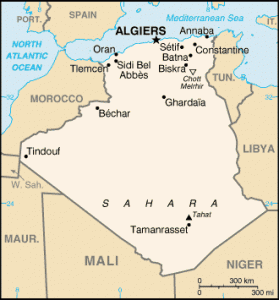
Algeria is a country in North Africa that is part of the Maghreb. It is bordered to the east by Tunisia and Libya , to the south by Niger and Mali , to the west by Mauritania , Western Sahara and Morocco . It is bathed in the north by the Mediterranean Sea.
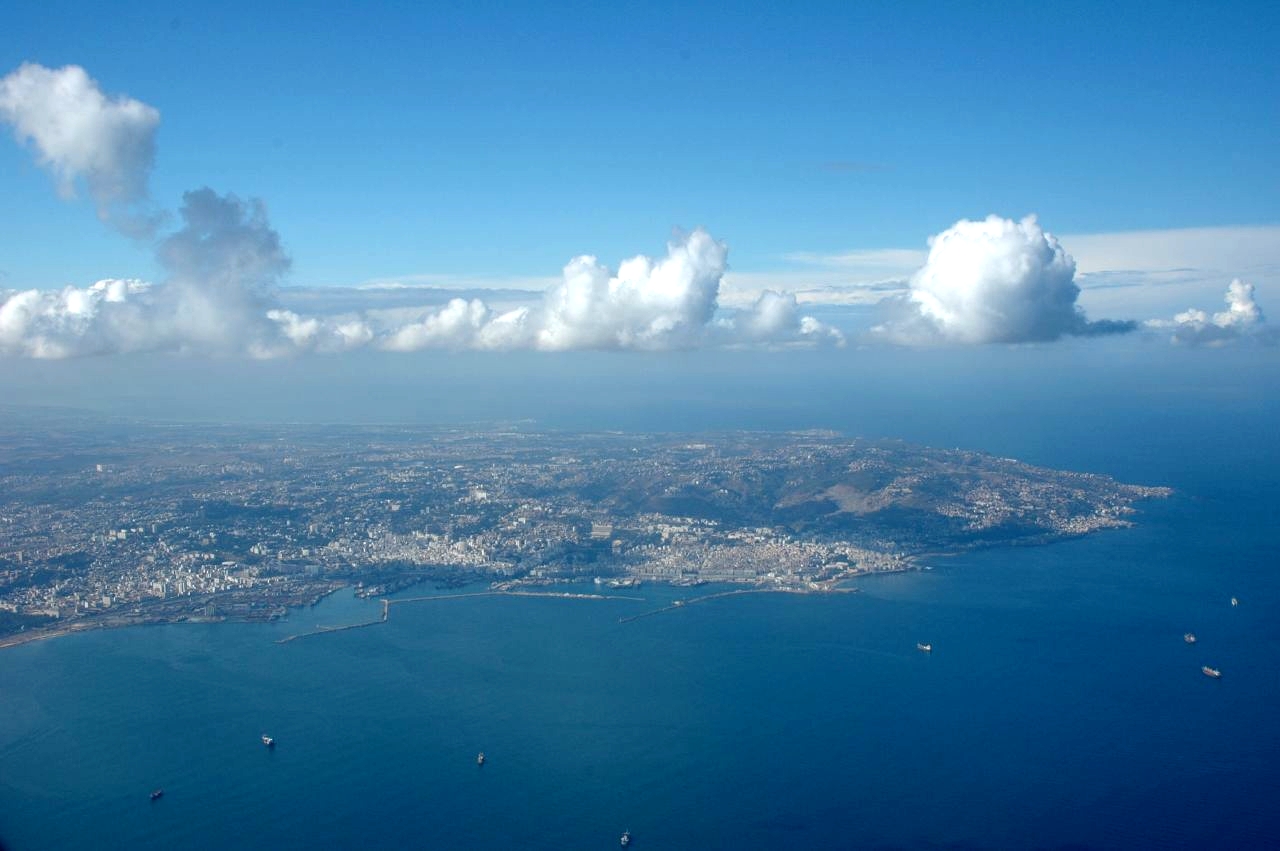
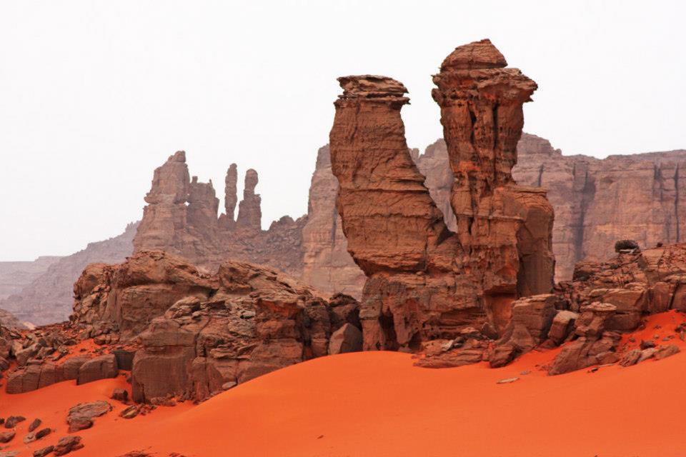
Alger, capital city of Algeria. Photo: Wikipedia The Red Tadrart in Djanet, south of Algeria. Source: Cap Djinet, Wikipedia Urban areas (2015) Urban areas Population Algiers (Alger) 7,796,923 inhabitants Oran 1,343,899 inhabitants Constantine 836,977 inhabitants Sétif 788,422 inhabitants Blida 771,706 inhabitants Djelfa 760,920 inhabitants Batna 684,999 inhabitants Annaba 395,037 inhabitants Sidi Bel Abbès 231,119 inhabitants Biskra 211,890 inhabitants Béjaïa 203,264 inhabitants Tébessa 197,636 inhabitants Tiaret 194,392 inhabitants El Oued 186,525 inhabitants Skikda 182,903 inhabitants Chlef 171,815 inhabitants Bordj Bou Arreridj 158,812 inhabitants Tamanrasset 103,533 inhabitants
Administrative divisions Provinces (Wilayas) Population Area Adrar 439,693 inhabitants 427,368 km² Aïn Defla 771,890 inhabitants 4,897 km² Aïn Témouchent 384,565 inhabitants 2,377 km² Alger 2,988,145 inhabitants 1,190 km² Annaba 640,050 inhabitants 1,439 km² Batna 1,128,030 inhabitants 12,192 km² Béchar 274,866 inhabitants 162,200 km² Béjaïa 915,835 inhabitants 3,268 km² Biskra 730,262 inhabitants 20,986 km² Blida 1,009,892 inhabitants 1,696 km² Bordj Bou Arreridj 716,423 inhabitants 3,920 km² Bouira 695,583 inhabitants 4,439 km² Boumerdès 802,083 inhabitants 1,456 km² Chlef 1,013,718 inhabitants 4,791 km² Constantine 943,112 inhabitants 2,197 km² Djelfa 1,223,223 inhabitants 32,256 km² El Bayadh 262,187 inhabitants 71,697 km² El Oued 673,934 inhabitants 54,573 km² El Tarf 411,783 inhabitants 3,339 km² Ghardaïa 375,988 inhabitants 86,105 km² Guelma 482,430 inhabitants 4,101 km² Illizi 54,490 inhabitants 284,618 km² Jijel 636,948 inhabitants 2,399 km² Khenchela 386,683 inhabitants 9,715 km² Laghouat 477,328 inhabitants 25,057 km²
See also